


The trail of maps in the history of a people
- It is known that cartography represents much more than the characteristics of a town or territory. Hand maps have conquered continents and empires have been built throughout history, and cultural and political identities have been defined with squads and cartabons. Peoples “without history” like Euskal Herria have often been drawn with foreign eyes, but the Basques, in spite of that, have continued to be subjects graphically represented. Imago Vasconiae gives us the opportunity to follow this trail.

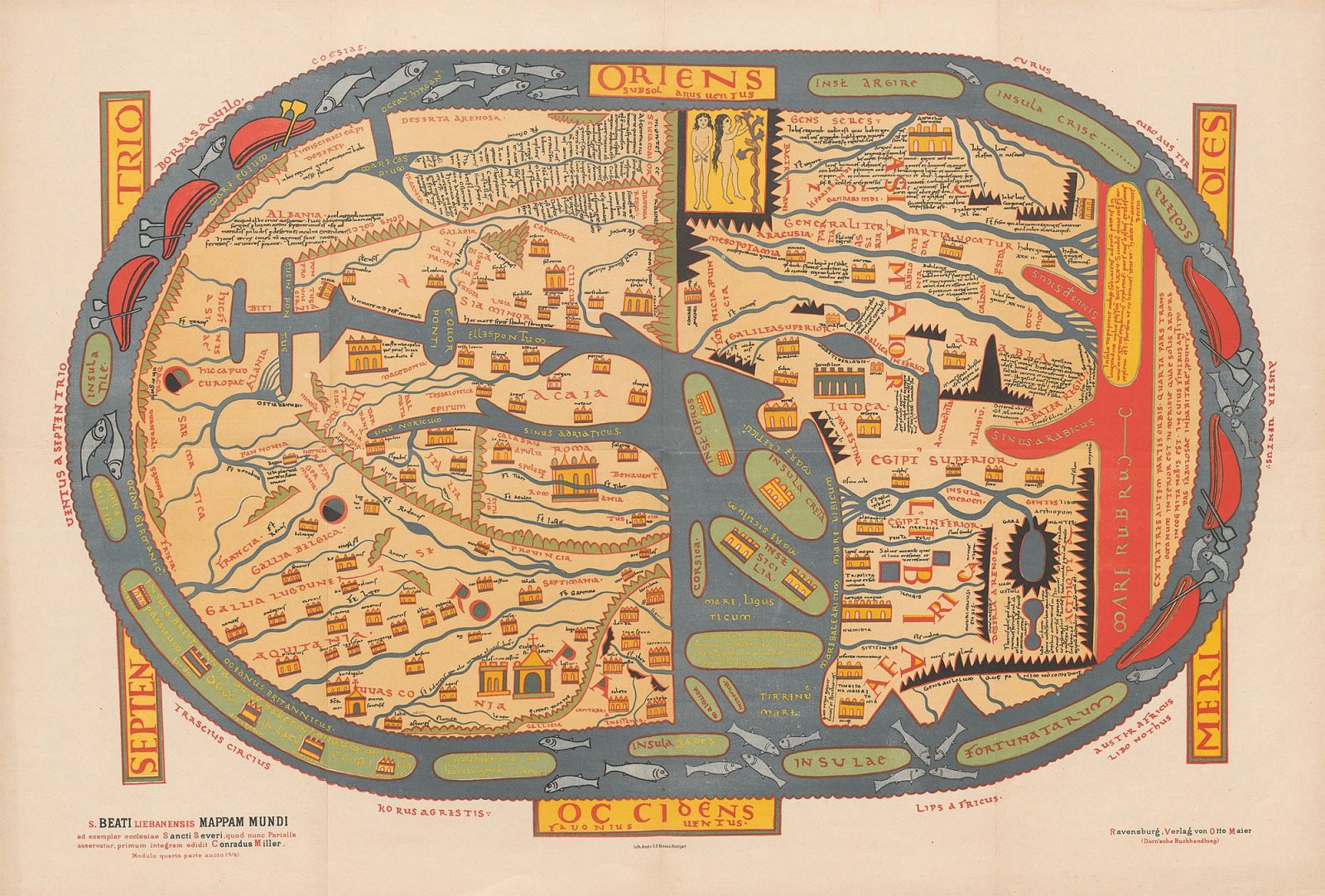
By the year 1050, a Benedictine monk living in the heart of the mountains of Europe drew an oval circle in the scroll with red, yellow and blue paintings, and gradually he was patiently drawing the image of the space around him and the time he lived, with the greatest accuracy possible, also trying to explain the Revelation of the Christian religion. This monk, the Liébena Beato, made one of the oldest maps we know, and on one shore of the European continent, north of the Pyrenees, he wrote the following word: DDasconia.
In Las Landas, the map has been stored in a manuscript of the former Saint Server monastery in Gascuña, next to the Aturri River, and is probably one of the oldest references in the territory where the Basque Country is located in a cartographic material. The Beato represented all the continents around the sea a thousand years ago, and the Sun and the Moon around them, as if the Earth were flat. Because maps have served to reflect reality itself through the centuries, or to bring reality to your own ideas.
Imago Vasconiae is the world map of Saint Server. Euskal Herria: Atlas of Historical Cartography (Txalaparta, 2024) is the second map that appears in the presentation of the work, the first is that of the Abauntz stone, made a few thousand years earlier (see table below). This collection, composed by the writer José Mari Esparza and the researcher Ramón Oleaga, aims to fill a great gap in the history of this town. Both experts in the field, with long experience in the field of mapping research, are a work of many years and many hours.
“In the first election we discover in some way thousands of examples that reflect our territory, to a greater or lesser extent,” explained Oleaga in the presentation of the collection. Catalogues of libraries and museums in many countries, as well as the funds of specialized institutions such as the Cartographic Institute of Catalonia or the National Geographic Institute (IGN), have been emptied for this purpose. From this “grosera” approach, a corpus of almost 800 maps was formed and for the atlas more than 300 have been selected, “which in our opinion account for the representation our people have had throughout history”, explains the investigador.El result is a careful
color edition of almost 450 pages, so as not to lose the smallest detail of each map, with explanations in Basque, French, Spanish and English. The work has been edited by the editorial Txalaparta and thanks to the funding of Laboral Kutxa.
.jpg)
But the atlas does not attach importance to the cover it gathers, but to its content and intentionality. In fact, although several catalogs had previously been published on maps of the Basque Country, the authors claim that there was a lack of a work covering the territory in a context of globality. Thus, according to Esparza, the atlas “will help to understand the evolution of Vasconia throughout history.” Since the creation of cartography, it has not been a mere science of measuring and explaining the land, but a tool of political action.
Projections of a spherical world
It's hard to tell what the first map you created can be. Numerous examples carved or drawn in stone indicate that hunters and collectors men were aware of the space they already surrounded in Prehistory. In the Middle East we can find murals to represent the cities of ancient civilizations, as well as what was said before Imago Mundi (World Map): The Babylonian grid from the 4th century to. C. offers a mythological view of the Earth. In China, maps dating before the Qin Dynasty have appeared on archaeological excavations.
Later, Greeks and Romans used cartographic techniques for military use. Greek astronomer Claudio Ptolemy offered in the second century guidelines and materials for the development of full maps in Geography, with thousands of toponyms. In the following centuries Ptolemy was a fundamental reference for many mappers, and for example, when in the 15th century his work was first printed, the names of genes and places of classical sources appear in the Basque territories.
.jpg)
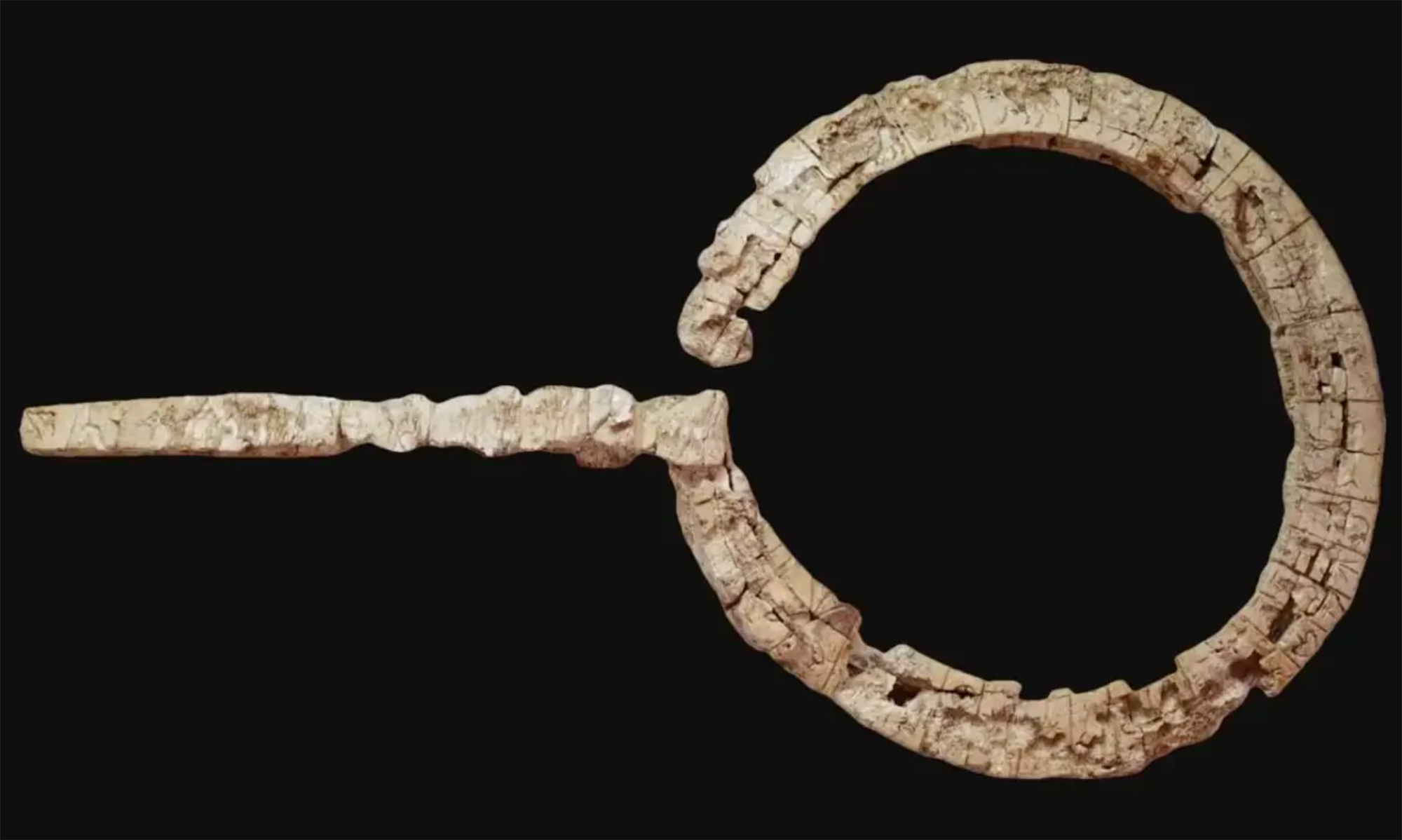
Abauntz cartographers
One of the oldest maps in the world is probably the so-called Abauntz Map or Abauntz Stone, as international scientists have also acknowledged. It was discovered in the cave of the same name around 1993 by archaeologists in the Ultzama Valley, in Arraiz, and after several years of study, in 2009 it was confirmed that we could be facing a cartographic document.
It was analyzed by the professor of Prehistory of the University of Zaragoza, Pilar Utrilla, along with Dr. Carlos Moza. Utrilla began digging in 1976 in the cave of Abauntz, driven by anthropologist Joxe Migel Barandiaran, and years later the engravings were discovered.
It is estimated that the map was built 13.660 years ago by prehistoric humans in a small record less than twenty centimeters long in the Magdalenian. According to the researchers, the rocks of San Gregorio, near the Haintzulo, as well as the step at their feet and some marshes not far from the Zaldatzain stream are represented. In addition, images of deer and other animals appear: "It can be a sketch or a simple map. Or you can imagine a plan for the next hunt, or maybe it's a story of something that's already happened," they say in the research. Who knows?
However, there are other cases that support the thesis of the map of Abauntz, as it is believed that they are representations of the landscape that surrounds us. In the Romanelli site, for example, in Italy, the meandars of a river have been identified, as well as in the roof of the cave of Gargas, in Occitania, which could belong to the River Garona.
Because if thousands of years ago they were able to fire, hunt and paint spectacular on the cliffs, why would those human beings who lived in symbiosis with nature not also draw the geography around them?
The maps realized with religious cosmological views of monasteries were ordered in the Middle Ages – such as the Blessed of Liébena-, but from the 16th century the expansionism of the European powers brought with it the proliferation of nautical or Portuguese charts, strategic and fundamental for the conquest of new territories. The emperors ordered the experienced cartographers to accurately define the lands and seas of their empires and kept them as a secret treasure, only in the hands of the military.
The atlas does not give importance to the portfolio it collects, but to its contents and intentionality: there was a lack of work covering the Basque territory in general
At a time when racism and European acism reached their peak, in the nineteenth century, cartography became a powerful instrument of domination and exploitation. Before the Scottish explorers determined the gigantic copper and cobalt pits, Leopoldo II.ak of Belgium was engaged in the genocide of the Congo, for example. The hotlines of the geopolitical map of Africa are nothing more than the vivid scars of colonialism. And they have come to us on a Eurocentric scale since in 1569 the Flemish geographer Gerardus Mercator disseminated the amorphous projection of the world, which shows Europe and North America as if they were larger, that image has triumphed, a symbol of the time when the white man dominated the world.
“This time cannot be eternalized using time and time again the geographic image of the world created by that minority,” wrote filmmaker and historian Arno Peters. Said and done: In 1974, half a century ago, he drew what he considered to be a fairer map of the world. The Earth plan based on the projection of Peters has been translated into eleven languages since then, also to Basque.
.jpg)
A people, eleven names
What about the Basques? Where and how do we stand in the trenches of cartography? From the 18th century on, for a people to be recognized as a subject or at least seen, it was essential to appear in charts and maps, since it was a people “without history” that did not exist without that window.
The territory in which the Basques lived has been called in a thousand ways in the past by their foreign eyes. Estrabón described over two thousand years ago: “...beyond there is the people of the Basques, and there is Pompelon, all as to say Pompeyópolis...”, he explained. A century later, in 1571, Joanes Leizarraga first wrote the word Heuscal-herria, translating the New Testament.
In other “maps of the time, we will see Navarre or Navarre to call the entire territory,” explains Esparza in Imago Vasconiae, while in the 19th century, the travels of anthropologists and linguists led to the publication of an increasingly abundant cartography, but “the Castilian names of the territory multiplied instead of unifying them,” says the writer Tafallés.
.jpg)
In late April 1801, the Prussian intellectual and diplomat Wilhem Humboldt began his second trip to the Basque Country from Paris. Two years earlier, when he first passed through these territories, he was impressed by the language and customs of the Basques: “Despite living within the two borders of France and Spain, they have a very special character and form,” he wrote in Die Bask’s book. But when applying comparative anthropology, Humboldt immediately realized the situation and destiny of the Basques: “This unfortunate people has also lost the unity of their name,” he explained, and then made a firm statement: “All the dispersed people in the French Basque Country, in the Basque provinces and in Navarre: the Basques are”.
Like Esparza, the professor of the UPV/EHU Joseba Agirreazkuenaga, who has dressed the atlas of historical context, has also been made significant that curse of the name that Humboldt has manifested, because Joanes Etxeberri de Sara and other authors speak of the Basques for a long time and without complexes, “even the name of Euskal”
According to Agirreazkuenaga “these subjects and agents, the Basques, are not timeless, nor ‘natural’, and they live in a space that has been graphically depicted in various maps and that, through stories and stories, they own themselves. In this way, more or less, they have demonstrated their own conscience, their own sympathy.” Therefore, maps are also a way of existing: as Father Manuel Larramendi tried in the 18th century to improve the vocabulary and grammar for the Basque Country, it is fair to create a map for the Basques to be part of our history.
Some authors talked about the Basques
for a long time and
without complexes, even the name “Euskal Herria”
The zoom of the maps is approaching
Maps, names, images and intertwined symbols, Esparza and Oleaga, as a puzzle, have created a complex photograph in Imago Vasconiae, as if there were some historical coordinates of Euskal Herria.
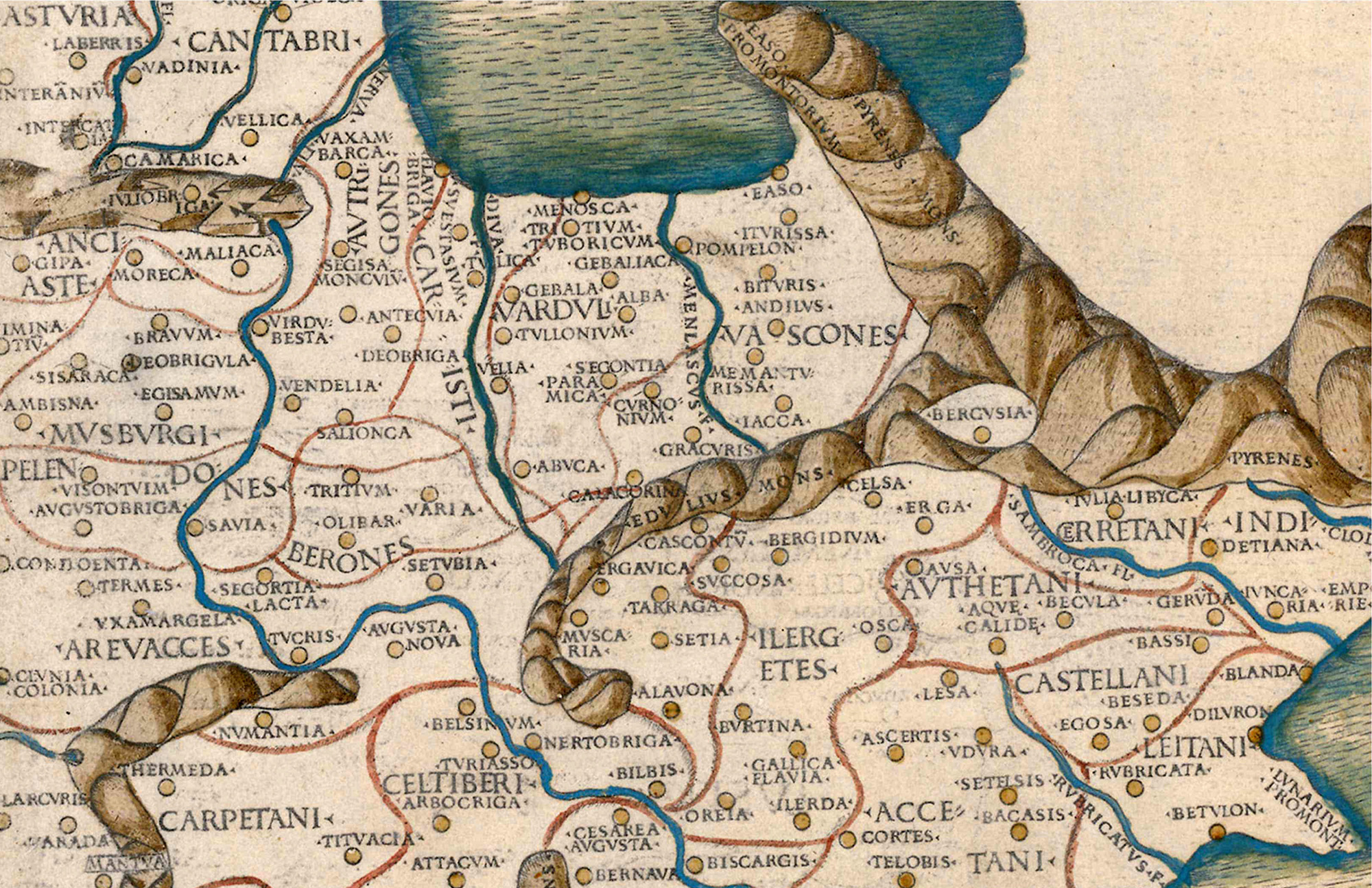
The Atlas begins with maps based on the information of Ptolemy, then the nautical charts with the names Biscaya and Biscai prevail. In this first section there are also the maps that determine the merinity of the kingdom of Navarre, both north and south of the Pyrenean ports. For example, an image of the prestigious cartographer Giacomo Cantelli, made in Rome in 1690, refers to Baja Navarra, Zuberoa and Lapurdi on the map of Navarra, as well as to a territory called “parte della Biscaia” (Bizkaia area), in the Cantabrian margin.
.jpg)
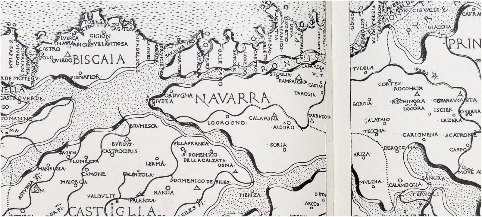
The nineteenth century was immersed in numerous conflicts and then more glorious maps were multiplied to meet the military needs of the great armies. But the liberal currents delved into the true being of peoples to state nations, and as a result, often the territories of the Basque Country appeared fragmented in those maps. However, there were exceptions, such as that made in 1817 by the British engraver Aaron Arrousmith on the occasion of the War of Independence: a yellowish and thick line runs along the banks of four provinces to represent the almost equal profile of the current Southern Basque Country.
.jpg)
Languages and Basque on maps
The cartography that has been produced on the Basque Country throughout history has been closely linked to the diffusion and use of the euskera.En Imago Vasconiae we have some significant examples of this.
In 1730, the linguist Gottfried Hensel used the Christian prayer Aita Gurea to place European languages on a map and put them in the Basque mold in the north of the Iberian Peninsula: Our father is so aicene...
The first map of the Basque Country was probably made in 1810 by Eúgene Coquebert de Montbret. After that, many others tried to do the same, C.F. Weiland included, for example, Baskowé on the list of the European language map in Czech. The maps of the Basque dialects of 1863 by Louis Lucien Bonaparte are well known.
The first map with the title in Basque is 1905: Geological plan carried out by the engineer Ramón Adam de Yarza or Euskalerrico Agerkai Lurkindarra. Eusko Ikaskuntza, for his part, ordered in 1922 the realization of a modern map of the seven provinces of Euskal Herria, with names in Basque. From there, many organizations followed this path, which was printed mainly in the diapo since 1936.
There is a map of 1961, made in San Sebastian during the dictatorship of Franco and with an unknown author. This map of Euskal Herria is entirely in Basque, with legends and at one end the mention of Joanes Etxeberri de Ziburu appears: "Pamplona, the leader of the Basques".This shows that, even in the most difficult times, cartography has served to reaffirm identities and claim.
In 1979, Euskaltzain José Luis Lizundia directed the publication of a large-scale and quality map for the Caja Laboral -Euskadiko Kutxa, with all the toponyms in Basque, from Nabarrioz to Kalagorri, from Kantauri to the Ebro.
Gradually, as Oleaga says, “as it advances in historical times, maps, like a photographic ‘zoom’, approach and improve scales and details.”
So we got to 20th century cartography, which brought a whole imaginary created by nationalism. In 1905 the Map of the Basque Country was published in Paris, a very extensive name since the San Sebastian Floral Games of 1894, with the seven provinces of the Basque Country. That was followed by many others, of course. The choreographic map of the Euskaleri’ko Charter by José Luis Zumárraga contained over 400 drawings reflecting the Basque Country of the 1930s. This map was reedited with great success by the Municipal Savings Bank of San Sebastian 50 years later, in 1983, and hung in numerous houses in Euskal Herria, just out of the Franco regime.
.jpg)
The latest map of the Imago Vasconiae collection is a tourist map of Ipar Euskal Herria in 2021. Now we're moving here and there thanks to the digital geographic search engines of the applications that we have on our mobile. But historical cartography remains a powerful weapon, as Sparza was once told, because “a people without atlas is a people without identity documents.”


Ereserkiek, kanta-modalitate zehatz, eder eta arriskutsu horiek, komunitate bati zuzentzea izan ohi dute helburu. “Ene aberri eta sasoiko lagunok”, hasten da Sarrionandiaren poema ezaguna. Ereserki bat da, jakina: horra nori zuzentzen zaion tonu solemnean, handitxo... [+]
Linear A is a Minoan script used 4,800-4,500 years ago. Recently, in the famous Knossos Palace in Crete, a special ivory object has been discovered, which was probably used as a ceremonial scepter. The object has two inscriptions; one on the handle is shorter and, like most of... [+]
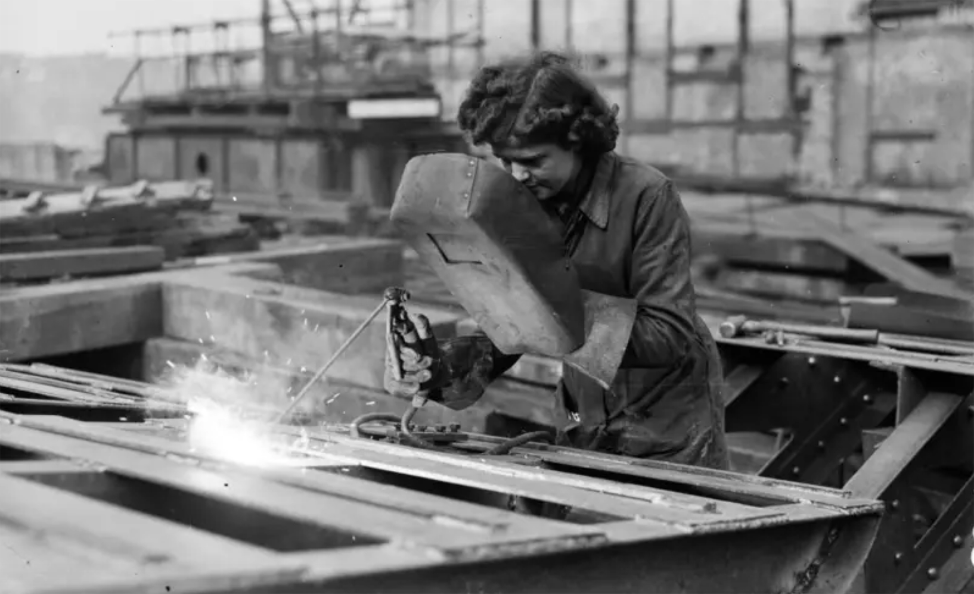
Londres, 1944. Dorothy izeneko emakume bati argazkiak atera zizkioten Waterloo zubian soldatze lanak egiten ari zela. Dorothyri buruz izena beste daturik ez daukagu, baina duela hamar urte arte hori ere ez genekien. Argazki sorta 2015ean topatu zuen Christine Wall... [+]
Kirola eta oroimena uztartuko dituzte, bigarrenez, mendi-martxa baten bitartez. Ez da lehiakorra izanen, helburua beste bat delako. La Fuga izeneko mendi martxak 1938ko sarraskia gogorarazi nahi du. Ezkabako gotorlekuan hasi eta Urepelen amaituko da. Maiatzaren 17an eginen dute.
Bilbo, 1954. Hiriko Alfer eta Gaizkileen Auzitegia homosexualen aurka jazartzen hasi zen, erregimen frankistak izen bereko legea (Ley de Vagos y Maleantes, 1933) espresuki horretarako egokitu ondoren. Frankismoak homosexualen aurka egiten zuen lehenago ere, eta 1970ean legea... [+]

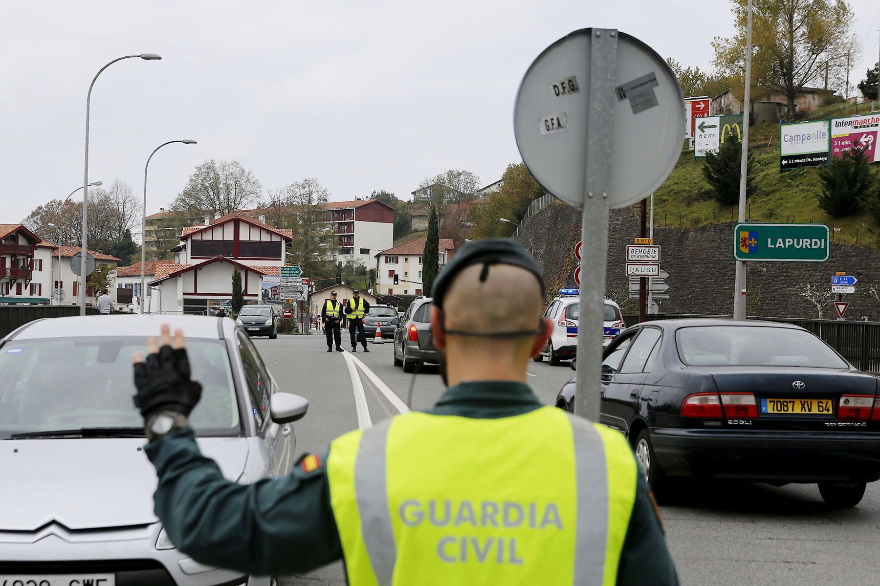
Fusilamenduak, elektrodoak eta poltsa, hobi komunak, kolpismoa, jazarpena, drogak, Galindo, umiliazioak, gerra zikina, Intxaurrondo, narkotrafikoa, estoldak, hizkuntza inposaketa, Altsasu, inpunitatea… Guardia Zibilaren lorratza iluna da Euskal Herrian, baita Espainiako... [+]
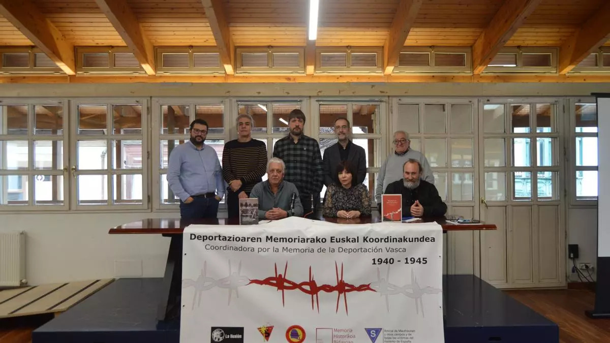
Deportazioaren Memoriarako Euskal Koordinakundeak aintzat hartu nahi ditu Hego Euskal Herrian jaio eta bizi ziren, eta 1940tik 1945era Bigarren Mundu Gerra zela eta deportazioa pairatu zuten herritarrak. Anton Gandarias Lekuona izango da haren lehendakaria, 1945ean naziek... [+]
Guardia Zibilaren historia bat - Hemendik alde egiteko arrazoiak izenburupean, datorren astean argitaratuko dugun 305. LARRUN aldizkariaren pasarte batzuk dira ondorengoak, erakunde armatuaren sorrera garaietan girotutakoak.

Iazko uztailean, ARGIAren 2.880. zenbakiko orrialdeotan genuen Bego Ariznabarreta Orbea. Bere aitaren gudaritzaz ari zen, eta 1936ko Gerra Zibilean lagun egindako Aking Chan, Xangai brigadista txinatarraz ere mintzatu zitzaigun. Oraindik orain, berriz, Gasteizen hartu ditu... [+]