


The oldest 3D map?
- Western Brittany, 3,900-3,650 years ago. The men who lived in the early Bronze Age in the Finisterre area recorded several lines, circles and images in a slab two meters long and a half wide. The engraved stone, now known as the slab of Saint-Bélec, was later buried in a grave.

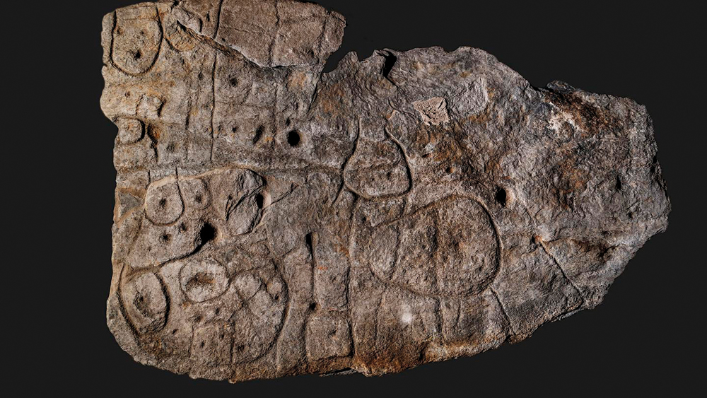
In 1900, archaeologist Paul du Chatellier found a pedrisco while digging in the necropolis of the area. The engraving was extracted from the tumulus and exhibited in the small museum it had in the castle of Kernuz (Pont-L’Abbé). They aroused Chatellier's curiosity, but did not know how to interpret them: “It’s hard to describe this curious monument full of cups, circles and images. Let us not be fooled by fantasy, let a Champolion that may show up one day read it on our own.”
In 1911, with the death of Chatellier, the family sold the entire collection (including the slab of Saint-Bélec) to the National Archaeological Museum of Saint-Germain-en-Laye. In the museum winery the slab was forgotten throughout the century, until it was rediscovered in 2014. Archeologists Yvan Pailler of the University of West Brittany and Clément Nicolas of the University of Bournemouth have been in charge of investigating the object. They have digitized the stone and analyzed in detail all the marks and changes made by man. For line reasons, they thought from the very beginning that it could have been a map. Then they saw that these cartographed precursors also modified the natural relief of the stone to represent the orography of a real area. So Saint-Bélec would be a three-dimensional map.
Finally, they have also come to the conclusion of which particular area of Brittany is on the map: 13 kilometres from the Odet River valley. In the rock you can identify the hills of Coadri, the Black Mountains and the massif of Landulan, the lines indicate the river network and some brands coincide with the remains of buildings, tumules or roads of the Bronze Age. Geolocation has concluded that the map represents the area with an accuracy of 80%. Several similar pieces have been found in the world, but so far it has not been possible to know the relief that these other maps represent. According to Clément Nicolas, “it can be the oldest map of an identified territory.”
Archaeologists don't know why the map was made, or why it was buried in a grave. Perhaps the authorities in that territory commissioned the work every time we had the territory, and when a lineage chief died, they decided to bury him with him. Or maybe the artist who engraved the stone burial along with his work. Clément Nicolas has one clear thing: “We tend to underestimate the geographic knowledge of societies of the past.”


Until now we have believed that those in charge of copying books during the Middle Ages and before the printing press was opened were men, specifically monks of monasteries.
But a group of researchers from the University of Bergen, Norway, concludes that women also worked as... [+]

Florentzia, 1886. Carlo Collodi Le avventure de Pinocchio eleberri ezagunaren egileak zera idatzi zuen pizzari buruz: “Labean txigortutako ogi orea, gainean eskura dagoen edozer gauzaz egindako saltsa duena”. Pizza hark “zikinkeria konplexu tankera” zuela... [+]
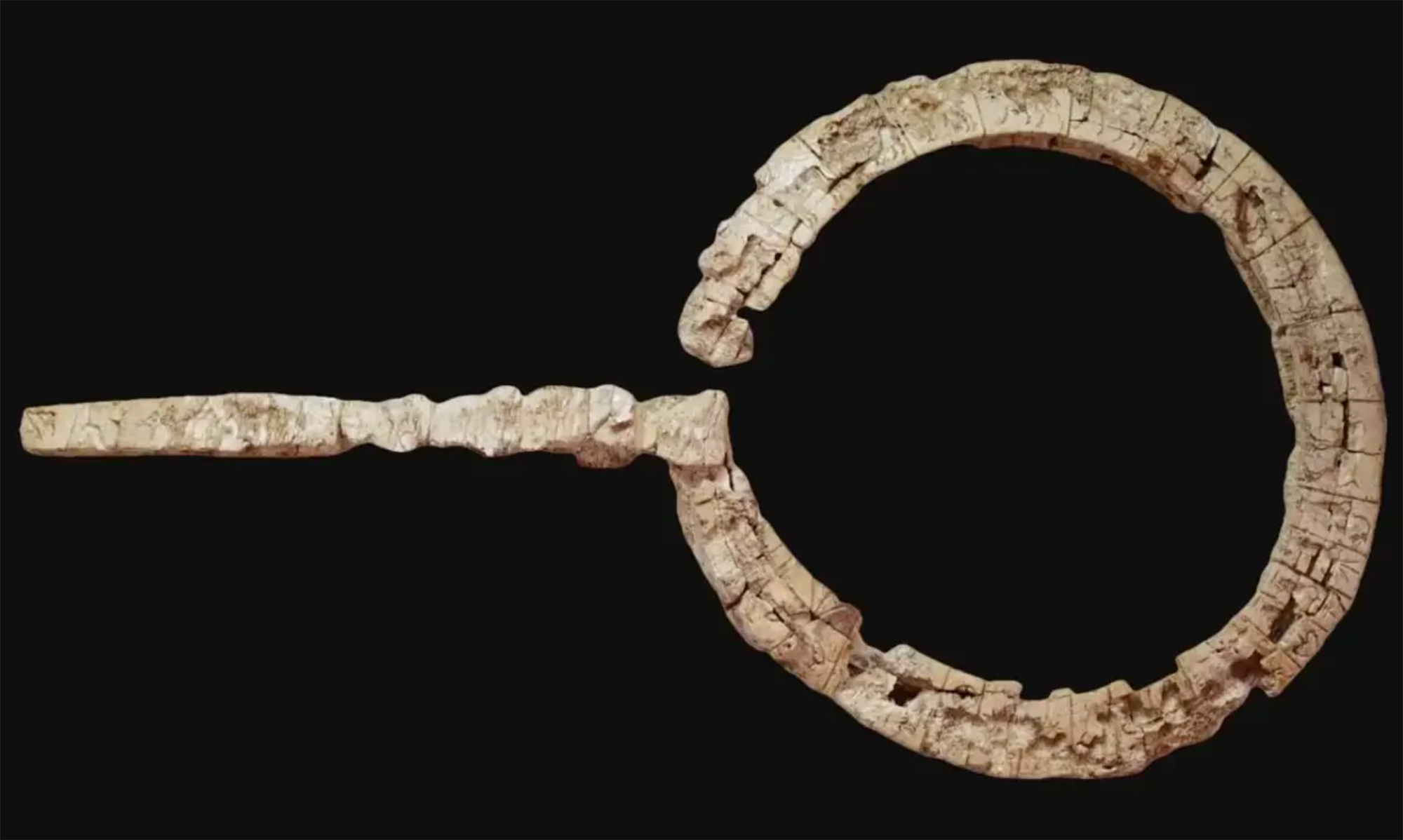
Linear A is a Minoan script used 4,800-4,500 years ago. Recently, in the famous Knossos Palace in Crete, a special ivory object has been discovered, which was probably used as a ceremonial scepter. The object has two inscriptions; one on the handle is shorter and, like most of... [+]
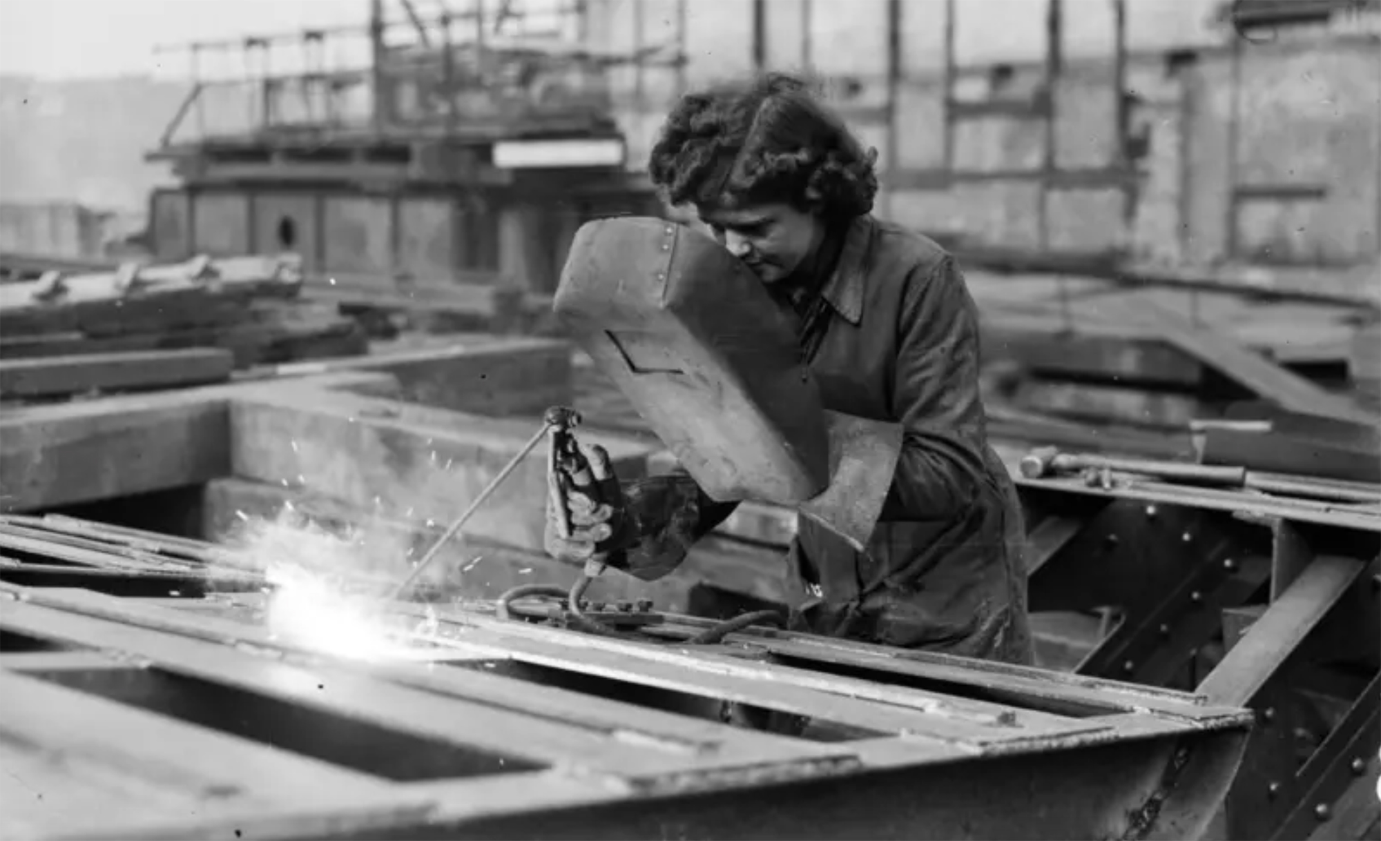
Londres, 1944. Dorothy izeneko emakume bati argazkiak atera zizkioten Waterloo zubian soldatze lanak egiten ari zela. Dorothyri buruz izena beste daturik ez daukagu, baina duela hamar urte arte hori ere ez genekien. Argazki sorta 2015ean topatu zuen Christine Wall... [+]
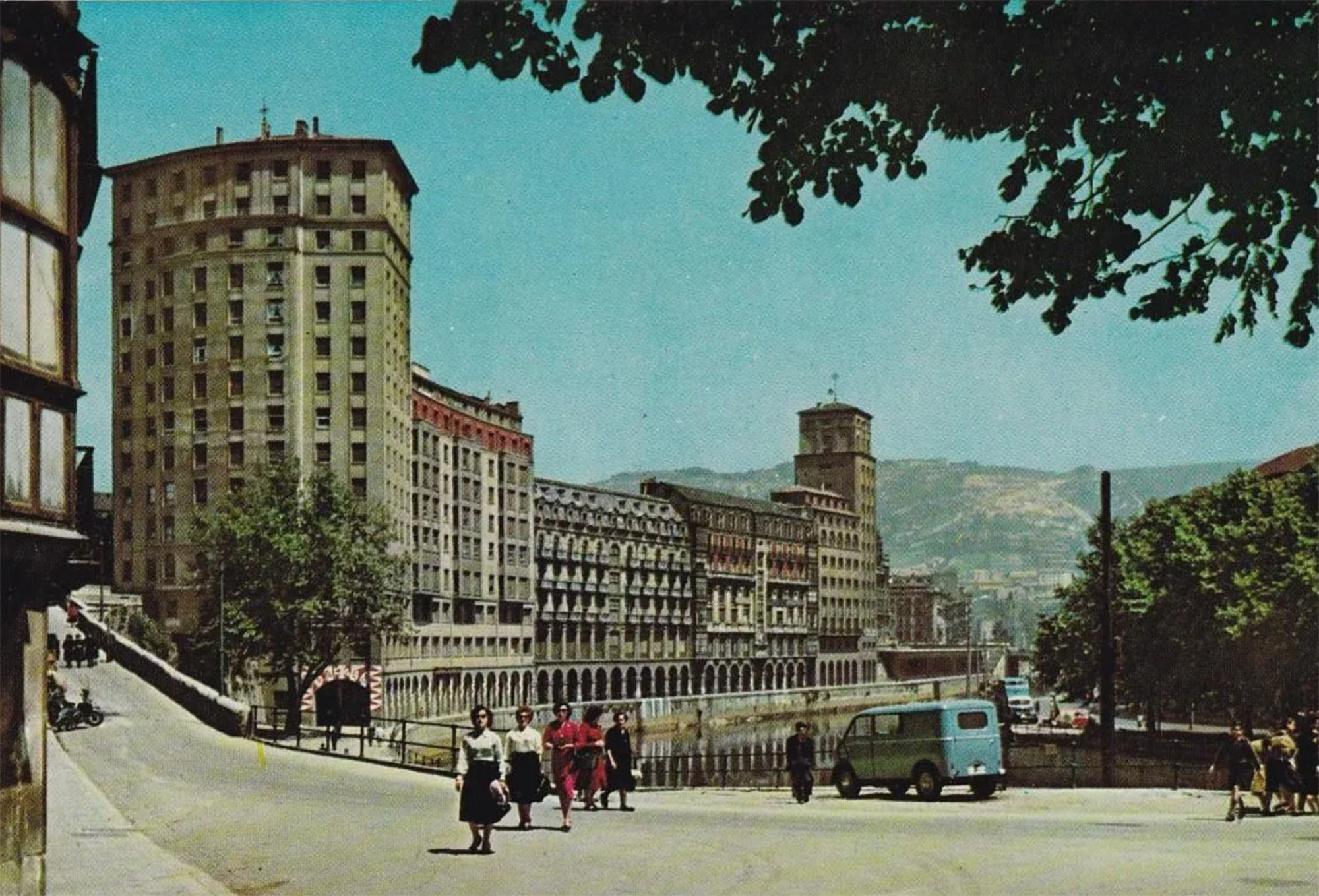
Bilbo, 1954. Hiriko Alfer eta Gaizkileen Auzitegia homosexualen aurka jazartzen hasi zen, erregimen frankistak izen bereko legea (Ley de Vagos y Maleantes, 1933) espresuki horretarako egokitu ondoren. Frankismoak homosexualen aurka egiten zuen lehenago ere, eta 1970ean legea... [+]

Japonia, XV. mendea. Espioitzan eta hilketa ezkutuetan espezializatutako eliteko talde militarra sortu zen. Edo horixe uste du behintzat Stephen Turnbull historialari britainiarrak. Beste aditu batzuen ustez, askoz lehenago sortu ziren ninjak, duela 2.300-2.500 urte inguru. Eta... [+]

Eskultura grekoerromatarrek bere garaian zuten itxurak ez du zerikusirik gaurkoarekin. Erabilitako materiala ez zuten bistan uzten. Orain badakigu kolore biziz margotzen zituztela eta jantziak eta apaingarriak ere eransten zizkietela. Bada, Cecilie Brøns Harvard... [+]
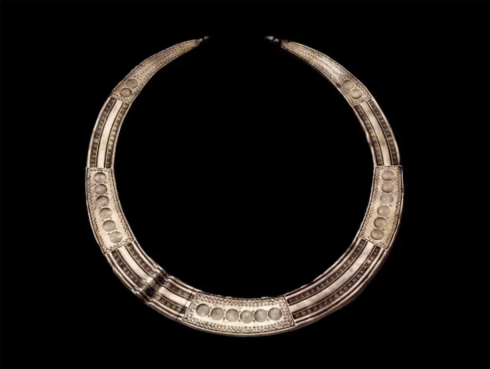
Chão de Lamas-eko zilarrezko objektu sorta 1913an topatu zuten Coimbran (Portugal). Objektu horien artean zeltiar jatorriko zilarrezko bi ilargi zeuden. Bi ilargiak apaingarri hutsak zirela uste izan dute orain arte. Baina, berriki, adituek ilargietan egin zituzten motibo... [+]
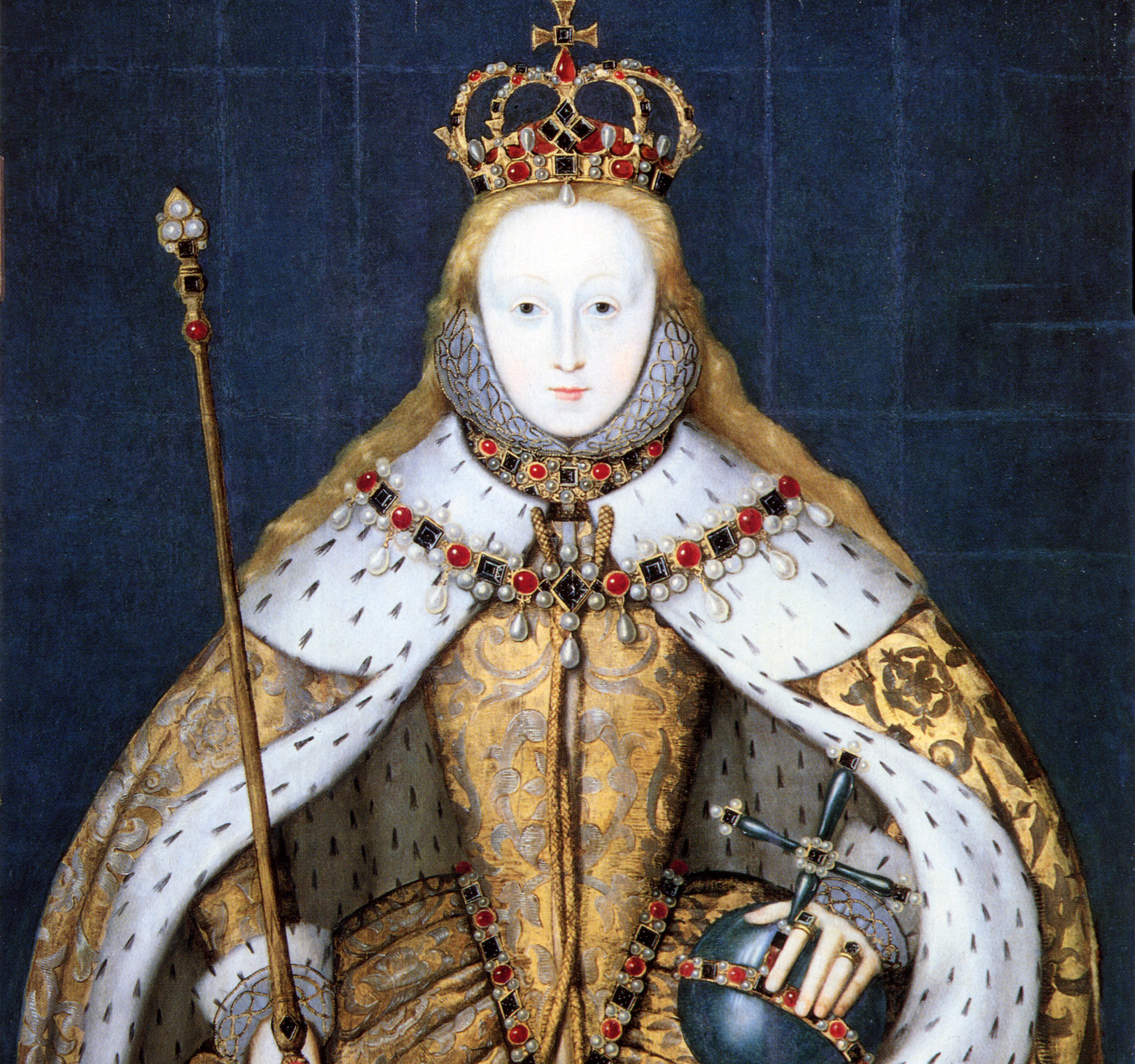
Hertfordshire (Ingalaterra), 1543. Henrike VIII.a erregearen eta Ana Bolenaren alaba Elisabet hil omen zen Hatfield jauregian, 10 urte besterik ez zituela, sukarrak jota hainbat aste eman ondoren. Kat Ashley eta Thomas Parry zaintzaileek, izututa, irtenbide bitxia topatu omen... [+]
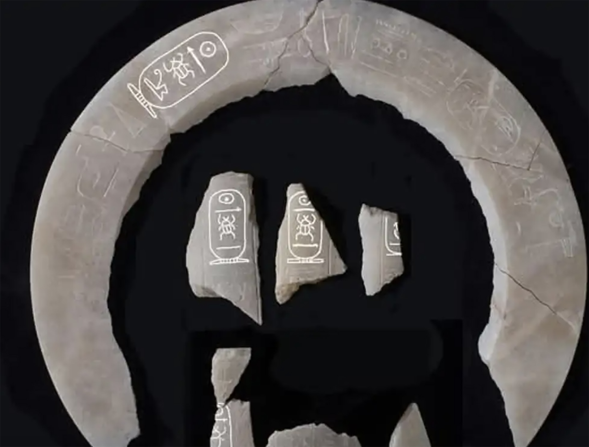
Luxorren, Erregeen Haranetik gertu, hilobi garrantzitsu baten sarrera eta pasabide nagusia aurkitu zituzten 2022an. Orain, alabastrozko objektu batean Tutmosis II.aren kartutxoa topatu dute (irudian). Horrek esan nahi du hilobi hori XVIII. dinastiako faraoiarena... [+]

AEB, 1900eko azaroaren 6a. William McKinley (1843-1901) bigarrenez aukeratu zuten AEBetako presidente. Berriki, Donald Trump ere bigarrenez presidente aukeratu ondoren, McKinleyrekiko miresmen garbia agertu du.
Horregatik, AEBetako mendirik altuenari ofizialki berriro... [+]
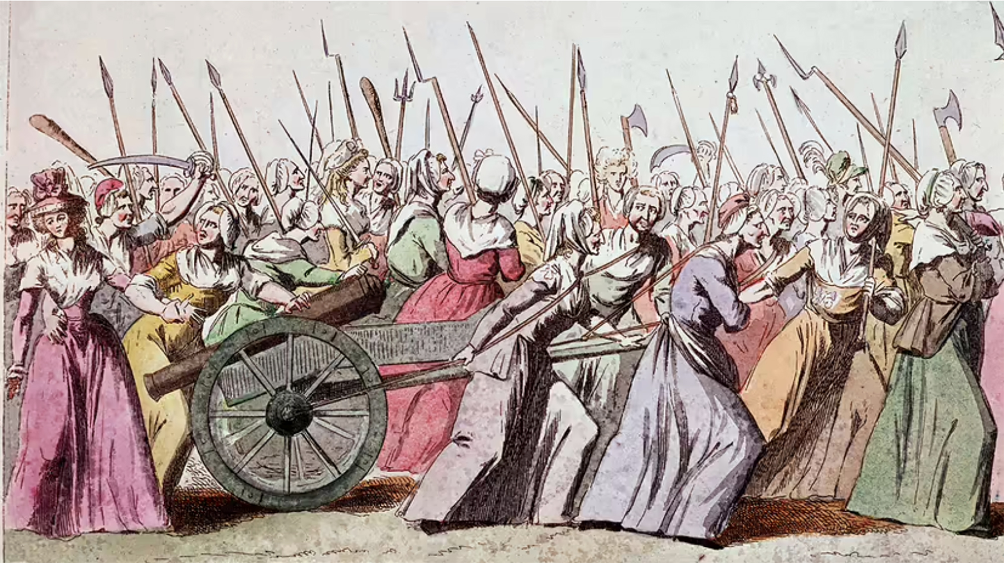
Urruña, 1750eko martxoaren 1a. Herriko hainbat emakumek kaleak hartu zituzten Frantziako Gobernuak ezarritako tabakoaren gaineko zergaren aurka protesta egiteko. Gobernuak matxinada itzaltzeko armada bidaltzea erabaki zuen, zehazki, Arloneko destakamentu bat. Militarrek... [+]
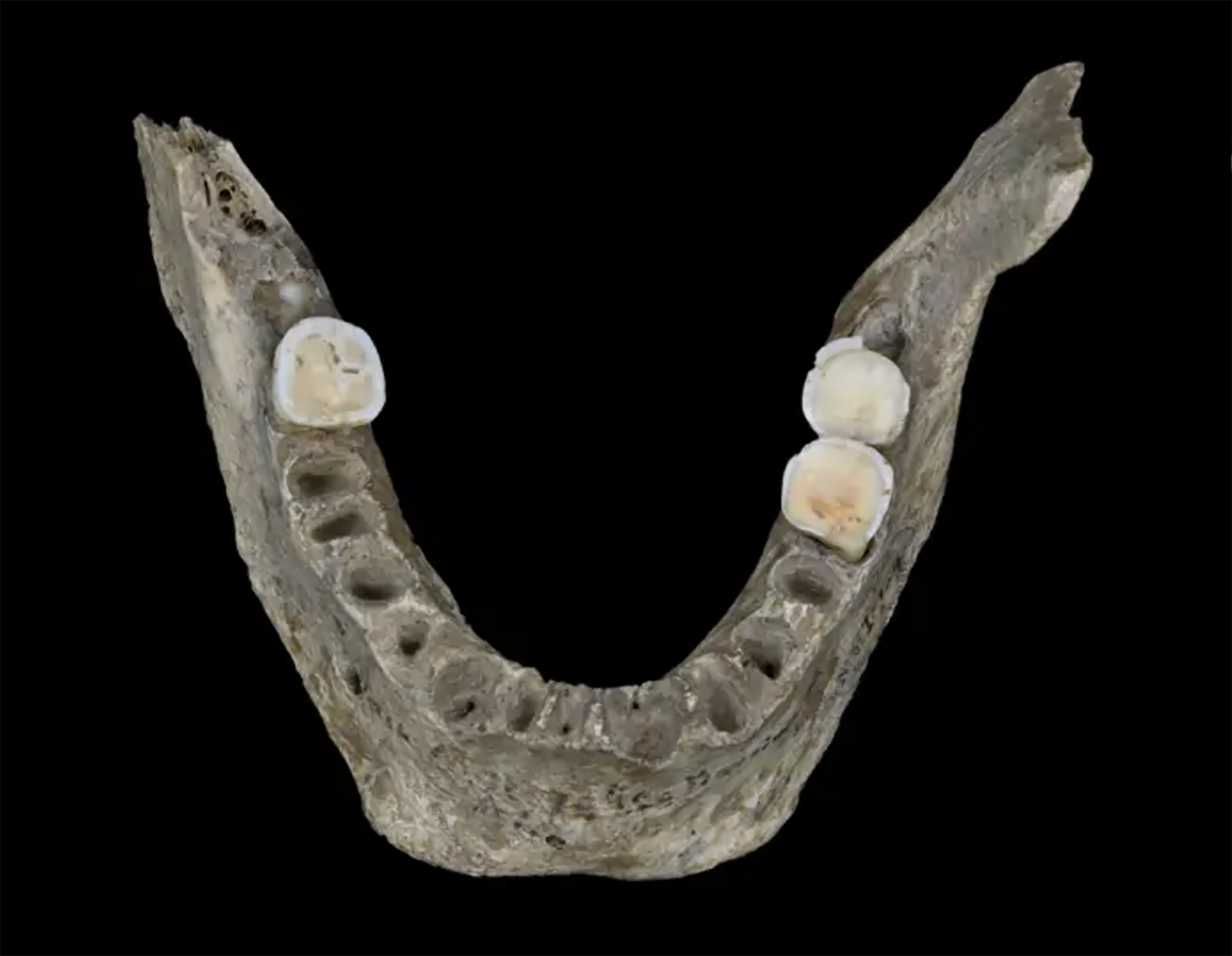
In the Maszycka cave in Poland, remains of 18,000 years ago were found at the end of the 19th century. But recently, human bones have been studied using new technologies and found clear signs of cannibalism.
This is not the first time that a study has reached this conclusion,... [+]
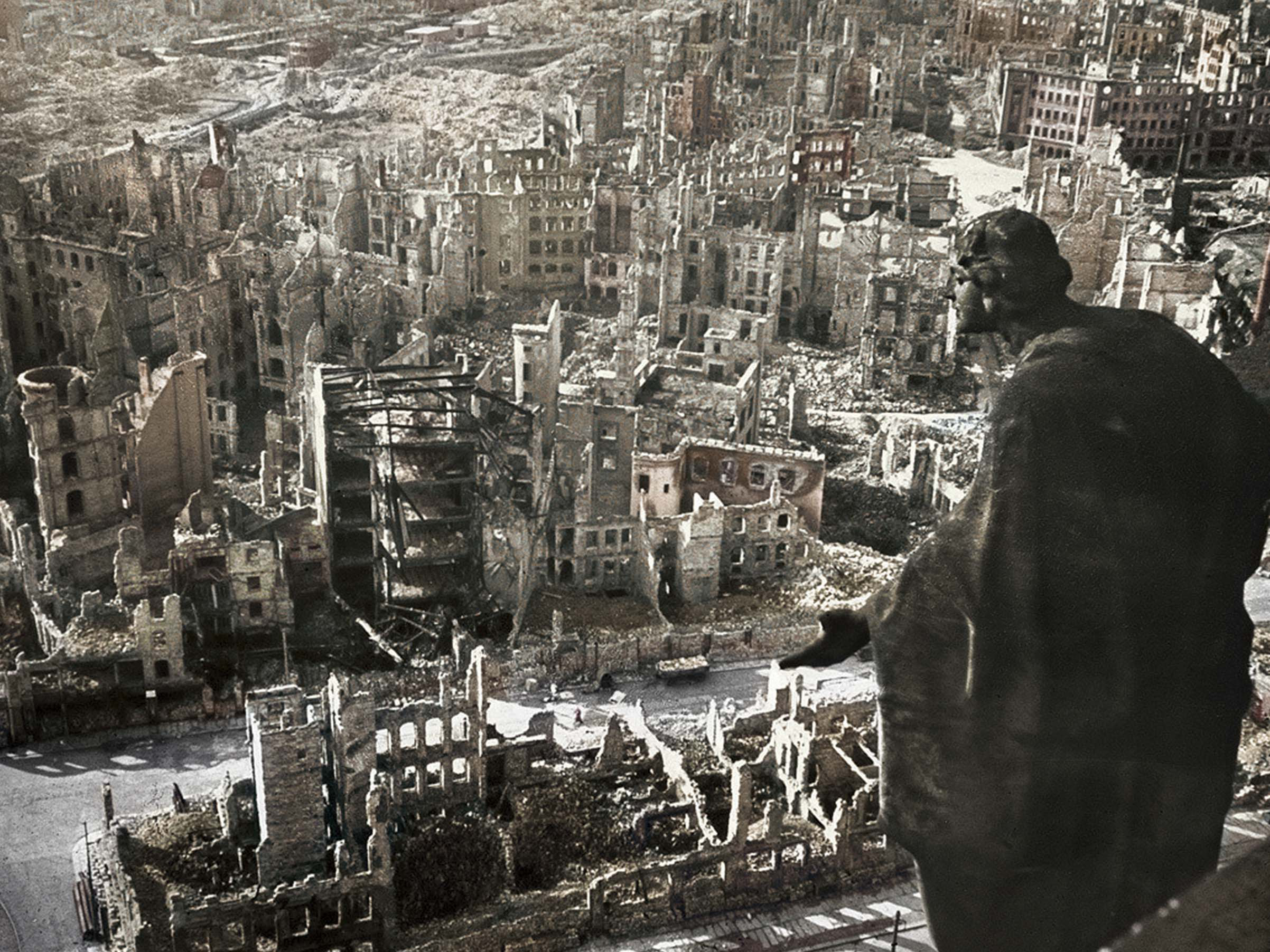
Porzheim, Germany, February 23, 1945. About eight o’clock in the evening, Allied planes began bombing the city with incendiary bombs. The attack caused a terrible massacre in a short time. But what happened in Pforzheim was overshadowed by the Allied bombing of Dresden a few... [+]
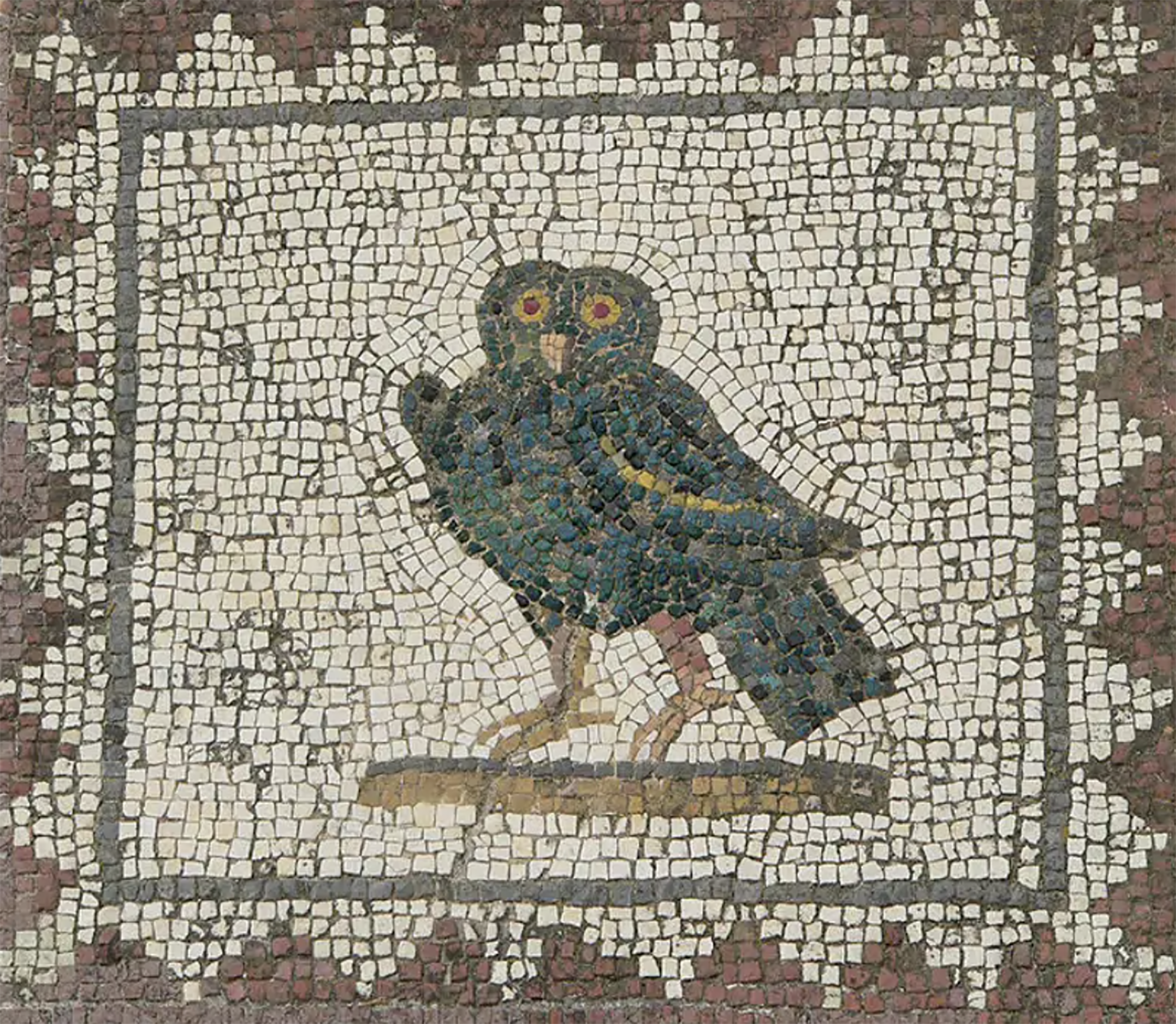
Poloniar ikerlari talde batek Sevillako Italica aztarnategiko Txorien Etxea aztertu du, eta eraikinaren zoruko mosaikoak erromatar garaiko hegazti-bilduma xeheena dela ondorioztatu du.
Txorien etxean 33 hegazti daude mosaikoetan xehetasun handiz irudikatuta. Beste... [+]