

Caught at sea, waiting for the seas to be carried
- TrailersDEM ®, the Coastal Risk Screening Tool app published by Climate Central, has generated in recent months a great stir due to the serious consequences that climate change could have in the short term in several areas of the world. In Euskal Herria, she has also been concerned about this publication, as much of society lives on the coast. Paraphrasing Jon Maia, “they’ll soon decide when to get up and down the tide.”

The results of the study have also been published as scientific articles in the international journal Nature Communications, in the issue S. A. Culp and B. H. Signed by Strauss researchers. A number of estimates have been prepared to identify areas at risk of flooding caused by sea rise in the twenty-first century. According to this data, although carbon emissions were reduced to low levels, by the year 2100 the living conditions of 340 million people underwater and 480 million keeping emissions at high levels could be curbed.
In the Basque Country, these conclusions would be felt throughout the entire coastline of Bizkaia, Gipuzkoa and Lapurdi, although with different intensity depending on the region. The most affected areas would be those at the mouth of the main rivers: In the case of Barbadun, the estuaries of the Ibaizabal (Ría de Bilbao), Butrón, Estepona, Urdaibai, Artibai, Iñurritza, Oria, Oiartzun, Bidasoa, Urdazuri, Uhabia and Atturri-Errobi, while in the case of the rivers Lea, Deba, Urola. In addition, it is significant to note that in the entire lower course of the Atturri River, on the border between the Basque Country and Gascuña, a vast estuary of almost 40 kilometres in length would be formed.
By the year 2100, the
cabin of 340 million people and the cabin of
480 million people could be stopped if emissions
were to remain high.
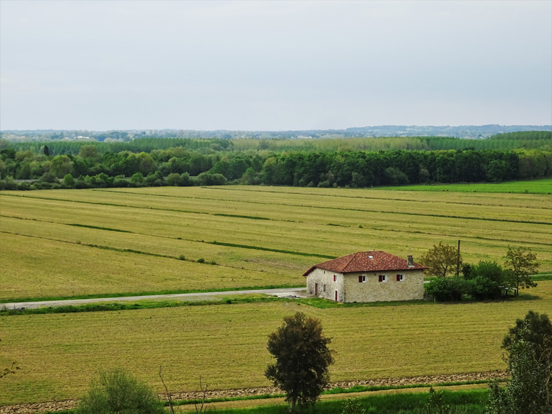
However, the consequences of climate change are a complex issue and it may be appropriate to expand the vision a little in order to be able to properly assess the reasons that have brought us to this situation. In fact, those now in danger are not just any area, but the estuaries of the major rivers. And until recently these estuaries have been covered with marshes and wetlands, providing effective ecological protection against the storm of tides for the communities stabilized in the environment; once this protection has disappeared, the important urban and industrial areas of the Basque coast are fully subject to sea level rise. The capitals of the three territories are a clear example: A large agglomeration formed around the estuary of Bilbao, the urban area of San Sebastian and the conurbation formed by the trio Bayonne–Anglés-Biarritz, but also many other secondary centres.
In order to understand this process, it is necessary to go back four centuries, since that is where the starting point for the artificialization of the Marshal ecosystems of the Basque estuaries is located.
Marshes, orchards, workshops
Since the Middle Ages, the estuarine marsh media were exploited as communal grounds for extensive activities such as fishing, hunting or gathering of Spartans. The change occurred in the early 17th century. At that time, the tendency to dry the marshes and to gain new farmland in several European countries was predominant: the clearest example is the famous Dutch polders, but the large wetlands of France and England were also adapted, in most cases on the Crown initiative and with the help of the Dutch engineer and investors. Following the same model, several municipalities of the Basque coast also began to grant permits for the closure and drying of the marshes, with the objective of constructing fields and orchards. In general, these were gloomy and humid environments that were particularly suitable for the cultivation of new crops coming from America, especially maize (Zea mays), which allowed the cultivation of many new lands and a significant increase in production in many areas.
Thanks to the documents of the time, we know in detail the system followed to transform the marshes into farmland. The first step consisted of the perimeter closure of a series of fences or dikes known as nipples and munas, which consolidated and supported the storms of the sea, opening channels and crossings to channel the waters and facilitate drainage through these new dried lands. The islands so delimited were much more stable than the original marsh, as they allowed considerable erosion to be reduced through water management. Many of these elements are still very present in the landscape of many estuaries, although most are very eroded.
Of course, in all the counties, the process of artificializing the marshes did not have the same strength or pace. For example, it seems that it started very early in the estuary of the Bidasoa (Gipuzkoa/Lapurdi), as the City Hall of Hondarribia ordered in 1698 to close the dam of Amute and dry the marshes of Jaitzubia to the ferreria of Urdanibia; shortly thereafter, in 1652, it was the City Hall of Irun that ordered the drying of the rents. At the same time, some residents began to close the junctures and create orchards in other areas of the town and, to regularize the situation, in 1694 the City Hall also auctioned these items. In the 18th and 19th centuries, all the marshes of the Bidasoa were transformed into orchards, transforming the estuary landscape.
Hendaya, Hondarribia and Irun form a conurbation of almost 100,000 inhabitants, largely stabilized on land that has been marshes, with San Sebastian airport located in the centre of the estuary
At the same time, in the first half of the seventeenth century, the drying process of the Ria de Atturri began. This estuary, which marks the border between Lapurdi and Gascuña, was almost 50 kilometres long and 4-6 kilometres wide and was covered with marsh from the Middle Ages. After the authorization of the king of France Enrique IV.ak in 1608, Dutch engineers began to build dikes and locks in this space, adapting the wetlands for cultivation and creating the characteristic landscapes that are called barta. Thanks to these systematic projects, the process was almost completed by the century
XIX.En other cases, the process was later. In the case of the estuary of Lea (Bizkaia), for example, the tidal mill of Isuntza (Mendexa) was in operation until 1723, and the drying of the marshes surrounding it had to wait for its abandonment. In the case of the Ria del Urola (Gipuzkoa), the trend has not been reinforced until the 1790s, when several investors from Zumaia began to promote the closure of the marshes between Usurbiribilaga and Basusta. The rest of the estuaries on the Basque coast experienced a similar evolution. In some cases, such as in Urdaibai and the Urumea, the drying of the marshes and the construction of artificial crops affected large expanses, radically transforming the aspect of the coastal landscape.
Subsequently, in the nineteenth and twentieth centuries, the process has been totally different: the urbanization and industrialization of the marshes. An extreme example in this field is undoubtedly provided by the Ría de Bilbao (Bizkaia): From the Seven Streets to the Port of Zierbena, Ibaizabal forms a large estuary that connects, along about 20 kilometers, the urban centers located on its shore. The industrial revolution completely transformed the aspect of this area, spreading urban centers, factories and working-class neighborhoods over many of the spaces that had previously been marshes, until it formed an urban agglomeration of almost a million inhabitants. Something similar has happened, since the middle of the twentieth century, in the center of San Sebastian (Gipuzkoa); in the marshes of the Urumea have been built neighborhoods such as Amara, with more than 30,000 inhabitants today. Similar industrialization and urbanization processes can be documented in marshes between Baiona and Angelu (Lapurdi), Irun, Hondarribia airport, Zarautz or Zumaia (Gipuzkoa), and Ondarroa, Gernika or Plentzia (Bizkaia), among others.
Nature or culture?
The trend towards the closure of the marshes and their conversion to crops, as well as the subsequent industrialization and urbanization processes, meant that most of the Basque coastal estuaries were deprived of ample space to the original Marshal ecosystem. Thus, the self-regulation resources of its own were suppressed, so that a large part of the estuaries became helpless in the face of possible floods as a result of the disasters and catastrophic events. These are now the environments most threatened by the risk of flooding as a result of climate change.
It is true that in recent decades steps have been taken along the way to stop this process and recover the natural marsh. The Urdaibai estuary is regarded, notably, as a Biosphere Reserve by UNESCO and is part of the List of Wetlands of International Importance established by the Ramsar Convention since 1993, in addition to being declared a Special Protection Area under the Natura 2000 Network. Many works have been carried out in this region in recent years for the recovery of the natural marshes, and today it is one of the most important natural parks in the Basque Country. The List of Wetlands of International Importance also includes the Bidasoa estuary, also declared as a Special Protection Area on both sides of the border. Here, however, the recovery of the marshes has been very partial, limited to the park of Plaiaundi and to some points of the Jaitzubia valley. In fact, the region is fully urbanized; Hendaia, Hondarribia and Irun form a conurbation of almost 100,000 inhabitants, largely stabilized on lands that had been marshes, with San Sebastian airport located in the center of the estuary.
Other estuaries included in the Natura 2000 network are Barbadun, Oria, Urola, Iñurritza and Atturri. However, after four centuries of radical artificialization of marsh ecosystems, the expansion of figures such as the Special Protection Zones has not allowed, although it has limited its degradation, to resolve by itself the weakness of the estuaries in the face of climate change. On the one hand, no natural park occupies more than a small part of the corresponding estuary, so the influence of the limited recovery of these “natural” marshes is not clear in a context in which the surrounding lands continue to be fully urbanized.
On the other hand, the aforementioned processes of polarising, industrialization and urbanization have completely transformed the topography and hydrography of the original marshes and, therefore, the dynamics of erosion and sedimentation. Therefore, the characteristics of the current ecosystem should be analyzed taking into account this historical intervention of the human being. For example, it may be interesting, in the definition of Special Protection Zones, rather than considering only natural or renaturalized spaces, to also protect the islands and banks that are still used in the area for cultivation, ensuring the proper maintenance of the canals, listeners and barriers existing in the area and avoiding their urbanization, so that these spaces can play a buffer function between the estuary and the habitats, limiting the negative effect of floods.
The case, as always, cannot be resolved within the framework of a rigid dichotomy between natural and artificial spaces. To address problems such as the effects of climate change and the degradation of ecosystems, it is essential to understand that every landscape is the result of the long-term interaction between the ecosystem and human activities and, in this regard, to work in an integrated manner all the factors that influence its codification, in order to seek sustainable solutions.
.jpg)
.jpg)
Paduren ustiaketari lotuta, kostako euskal gizarteek hainbat hitz eta esamolde erabili dituzte. Gaur egun, ogibide tradizionalen galerarekin batera, lexiko hori ia ahaztuta gelditu da neurri handi batean.
Padura terminoa bera palude hitz latinotik eratorria da. XI. mendeaz geroztik ageri da toponimo gisa dokumentatuta, kostan zein barnealdeko eremu zingiratsuetan.
Behin laborantzarako egokituta, erribera eta isla terminoak izan dira ohikoenak espazio hauei erreferentzia egiteko, toki askotan kontserbatu den toponimiak zein adineko bizilagunen memoriak erakusten dutenez. Eremu hauei loturik, batik bat hiru elementu aipa daitezke:
Lezoiak edo Munak. Orotariko Euskal Hiztegiak bi adiera jasotzen ditu lezoi hitzarentzat: “Itxitura funtzioa duen lubaki edo trintxera” eta “hesia”; Lapurdin nahiz Gipuzkoa ekialdean, padurak ixteko dikeak izendatu izan ditu, eta litekeena da Lezo herriaren izena ere hemendik eratorria izatea. Bizkaian, aldiz, muna hitza erabili izan da, Urdaibain adibidez.
Kanalak. Alde batetik, padurak artifizializatzean ibai eta erreka ugari kanalizatu ziren. Bestalde, itxitako lursailetan drenaia errazteko beharrezkoa izango zen kanal txikiak irekitzea, sare hidrografikoa erabat itxuraldatuz.
Langak. Zentzu zabalean, sail baten sarbidea lotzen duen ataka da langa. Paduren kasuan, hitz honek egitura berezi bati egiten dio erreferentzia; horri esker, kanalek drainatutako ura aisa drainatzen da, baina kontrako norabidean, mareen igoerarekin iristen denari bidea ixten zaio.
Gainera, paduren ustiapen-eredu berezi honek harreman espezifiko bat sortu zuen tokian tokiko komunitateen eta estuario-ekosistemaren artean, eta hori toponimia aberats batean islatu zen. Leku-izen hauek ere galtzen ari dira gaur egun, zentzua eman zieten harremanak desagertuta.


Herriko EH Bilduko zinegotzi eta legebiltzarkide den Ander Goikoetxeak egindako galdera parlamentario bati Jaurlaritzak emandako erantzunaren bidez jaso informazioa hau. Bi haize sorgailu ezartzeko asmoa dago eta Cluster Hernani izeneko proiektu zabalago baten barruan kokatzen... [+]

Eskola inguruko natur guneak aztertu dituzte Hernaniko Lehen Hezkuntzako bost ikastetxeetako ikasleek. Helburua, bikoitza: klima larrialdiari aurre egiteko eremu horiek identifikatu eta kontserbatzea batetik, eta hezkuntzarako erabiltzea, bestetik. Eskola bakoitzak natur eremu... [+]
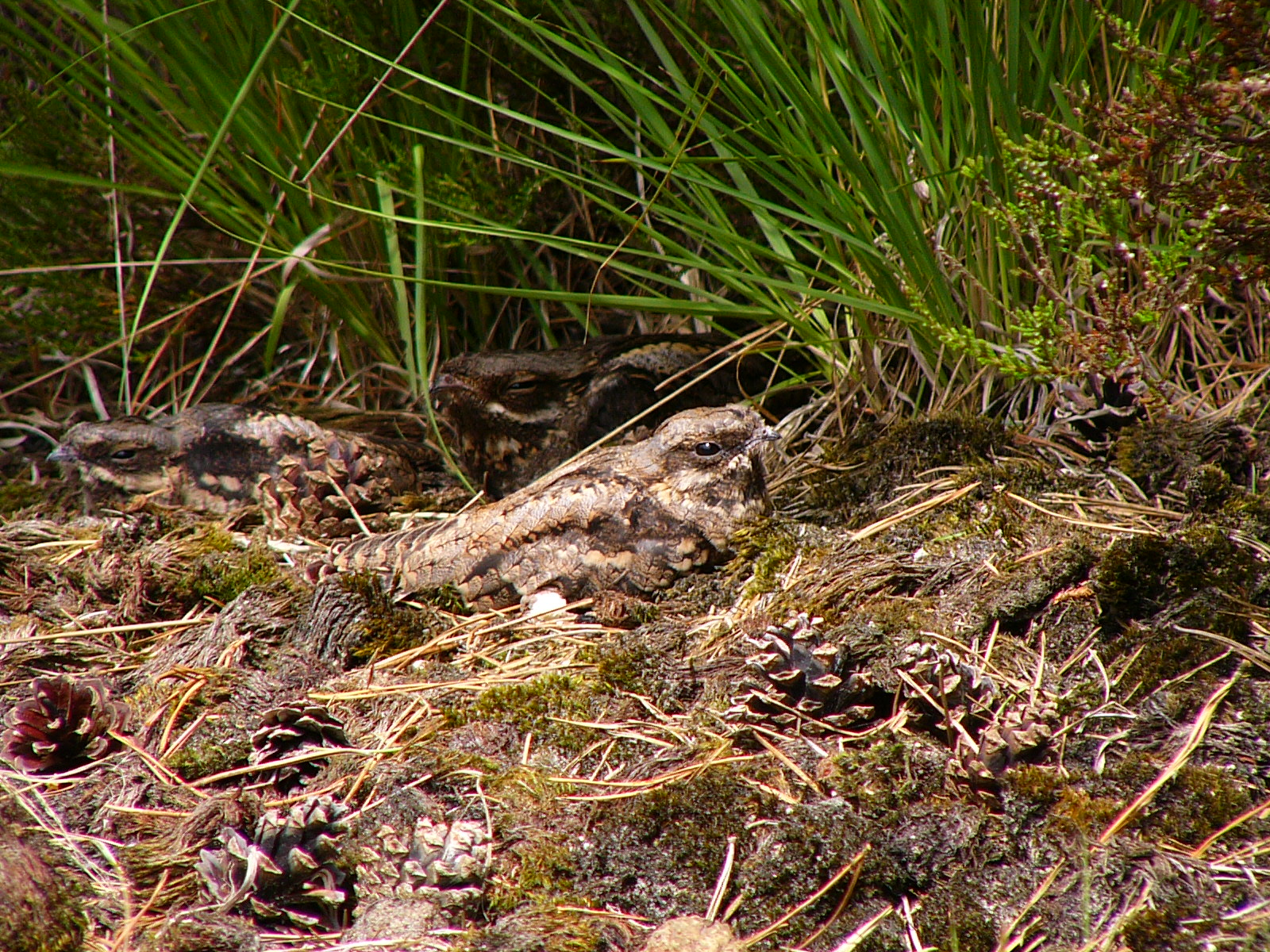
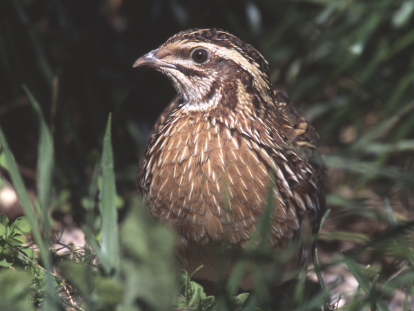
Katalanen ustetan artzainak engainatzen omen ditu hegazti honek: “enganyapastors”. Espainiar eta latindarrek, aldiz, ahuntzari esnea kentzen diola diote, hortik datorkio hain zuzen ere izen zientifikoan (Caprimulgus europaeus) islatzen den caprimulgus (capra... [+]

Andeetako Altiplanoan, qocha deituriko aintzirak sortzen hasi dira inken antzinako teknikak erabilita, aldaketa klimatikoari eta sikateei aurre egiteko. Ura “erein eta uztatzea” esaten diote: ura lurrean infiltratzen da eta horrek bizia ekartzen dio inguruari. Peruko... [+]

Mendizale batek asteburuan ikusi du animalia Lapurdiko Azkaine herrian, eta otsoa dela baieztatu du Pirinio Atlantikoetako Prefeturak. ELB lurraldean "harraparien presentziaren kontra" agertu da.
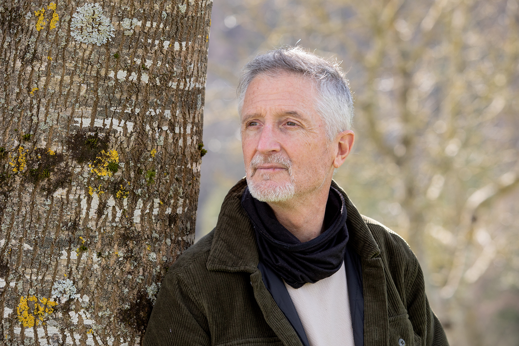
Biologian doktorea, CESIC Zientzia Ikerketen Kontseilu Nagusiko ikerlaria eta Madrilgo Rey Juan Carlos unibertsitateko irakaslea, Fernando Valladares (Mar del Plata, 1965) klima aldaketa eta ingurumen gaietan Espainiako Estatuko ahots kritiko ezagunenetako bat da. Urteak... [+]
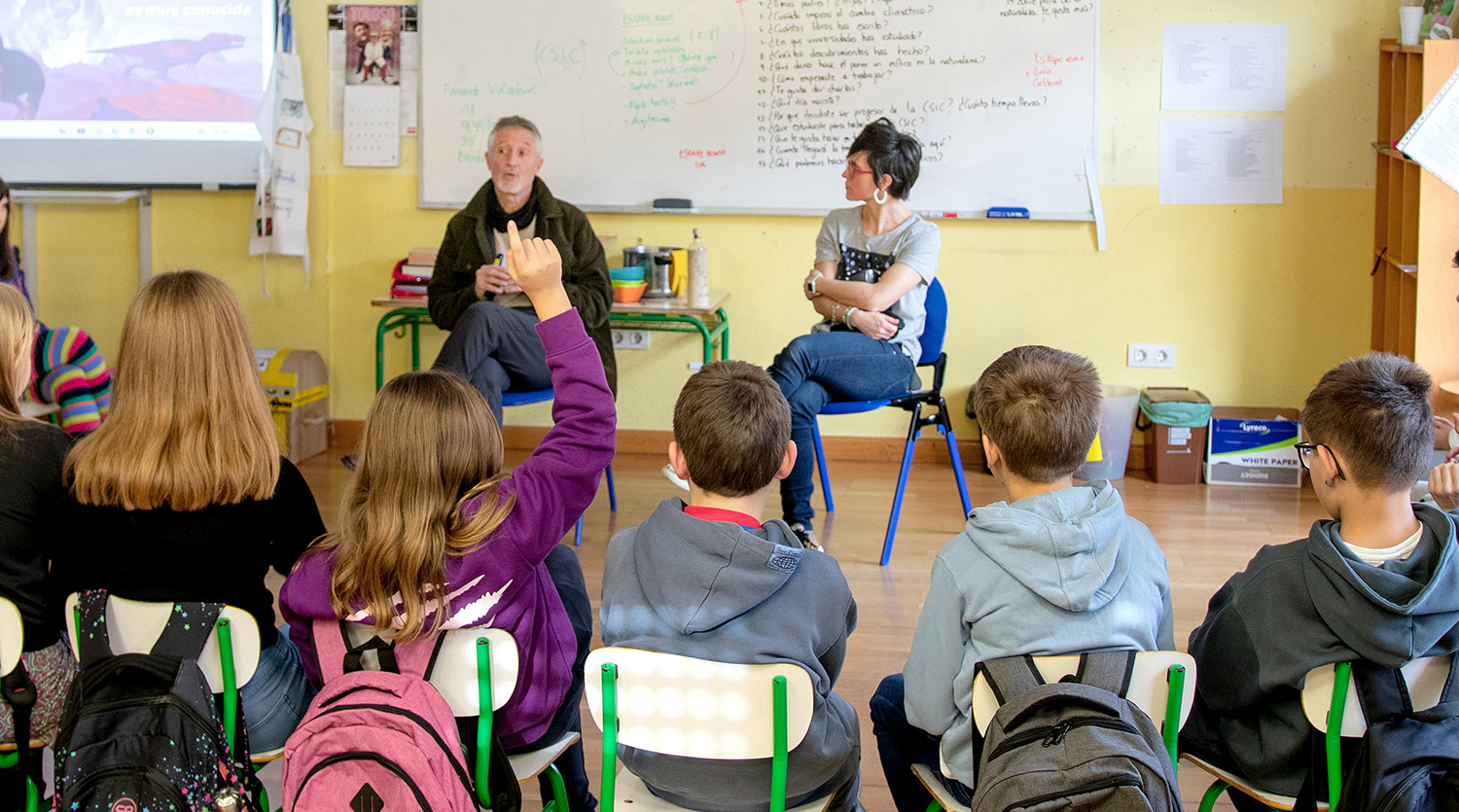
Nola azaldu 10-12 urteko ikasleei bioaniztasunaren galerak eta klima aldaketaren ondorioek duten larritasuna, “ez dago ezer egiterik” ideia alboratu eta planetaren alde elkarrekin zer egin dezakegun gogoetatzeko? Fernando Valladares biologoak hainbat gako eman dizkie... [+]

Nekazal eremu lehor baten erdian ageri da putzua. Txikia da tamainaz, eta ez oso sakona. Egunak dira euririk egiten ez duela, baina oasi txiki honek oraindik ere aurretik bildutako urari eusten dio. Gauak eremua irentsi du eta isiltasunaren erdian kantu bakarti bat entzun da... [+]
Eskoziako Lur Garaietara otsoak itzularazteak basoak bere onera ekartzen lagunduko lukeela adierazi dute Leeds unibertsitateko ikertzaileek.. Horrek, era berean, klima-larrialdiari aurre egiteko balioko lukeela baieztatu dute, basoek atmosferako karbono-dioxidoa xurgatuko... [+]
_Glaciar.png)