

Triple trip nowhere

Melanesia, 1774. The famous captain James Cook drew a large island of sand on a map covering the current area of New Caledonia. The captain named the island Sandy, a sign of its ingenuity and originality. This island was reproduced in maps until the year 2000. Until the cookies proved that there was no more than water in the place drawn. Is it possible that the alleged amount of sand discovered by the explorer has been submerged over the centuries? No, because in that area the ocean is about 1,400 meters deep.
The fact is that at one time the French claimed, and succeeded, the rights on the part of land that does not exist. Since then, this empty water area is called Ile de Sable.
An English whale, Captain Dougherty, reported in 1841 that he had found a small island near Australia. In all humility he called him the island of Dougherty. In the original description the captain said the alleged land was covered in snow, but a 1909 expedition was unable to find the island. Years later, a fellow man from Cook and Dougherty, Captain Davis, wrote: “I have the impression that the island of Dougherty has collapsed.” There wasn't the island either, but in this case the fishing whale didn't get right what it had seen, but found an iceberg.
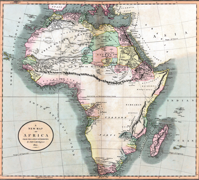
In 1798, the cartographer James Rennel, based on the information provided by the Scottish explorer Mungo Park, drew on a map of central Africa a chain of thousands of kilometres: Kong Mountains. A gigantic mountain range would pass through, among others, the present Nigeria and Sierra Leone.
Rennel, the founder of the Royal Geographical Society of London, did not doubt what he had drawn and, for a hundred years, travelers gave a long rodeo to avoid the abrupt orography. Of course, when Frenchman Luis Gustave Binger decided to explore the mountain range on purpose, he found nothing. So in the late 19th century, the mountains of Kong began to be removed from the maps.


Washington, D.C., June 17, 1930. The U.S. Congress passed the Tariff Act. It is also known as the Smoot-Hawley Act because it was promoted by Senator Reed Smoot and Representative Willis Hawley.
The law raised import tax limits for about 900 products by 40% to 60% in order to... [+]

During the renovation of a sports field in the Simmering district of Vienna, a mass grave with 150 bodies was discovered in October 2024. They conclude that they were Roman legionnaires and A.D. They died around 100 years ago. Or rather, they were killed.
The bodies were buried... [+]


My mother always says: “I never understood why World War I happened. It doesn't make any sense to him. He does not understand why the old European powers were involved in such barbarism and does not get into his head how they were persuaded to kill these young men from Europe,... [+]


Until now we have believed that those in charge of copying books during the Middle Ages and before the printing press was opened were men, specifically monks of monasteries.
But a group of researchers from the University of Bergen, Norway, concludes that women also worked as... [+]

Florentzia, 1886. Carlo Collodi Le avventure de Pinocchio eleberri ezagunaren egileak zera idatzi zuen pizzari buruz: “Labean txigortutako ogi orea, gainean eskura dagoen edozer gauzaz egindako saltsa duena”. Pizza hark “zikinkeria konplexu tankera” zuela... [+]

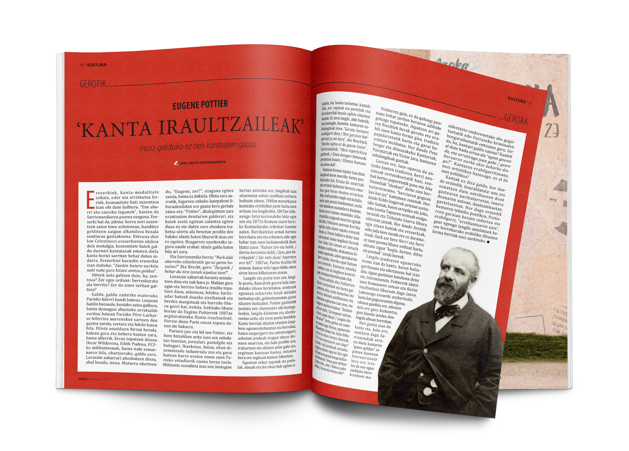
Ereserkiek, kanta-modalitate zehatz, eder eta arriskutsu horiek, komunitate bati zuzentzea izan ohi dute helburu. “Ene aberri eta sasoiko lagunok”, hasten da Sarrionandiaren poema ezaguna. Ereserki bat da, jakina: horra nori zuzentzen zaion tonu solemnean, handitxo... [+]
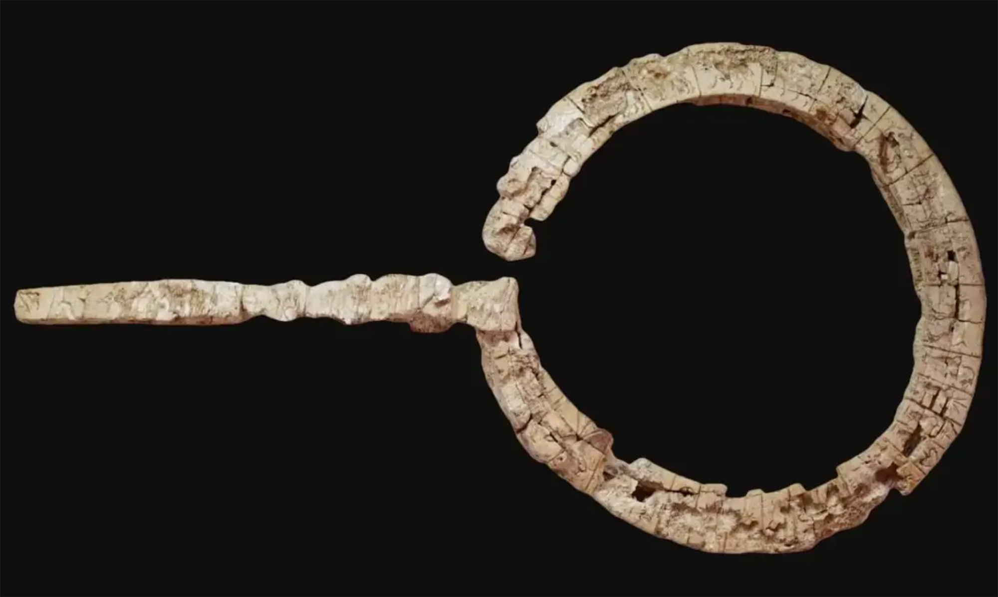
Linear A is a Minoan script used 4,800-4,500 years ago. Recently, in the famous Knossos Palace in Crete, a special ivory object has been discovered, which was probably used as a ceremonial scepter. The object has two inscriptions; one on the handle is shorter and, like most of... [+]

Londres, 1944. Dorothy izeneko emakume bati argazkiak atera zizkioten Waterloo zubian soldatze lanak egiten ari zela. Dorothyri buruz izena beste daturik ez daukagu, baina duela hamar urte arte hori ere ez genekien. Argazki sorta 2015ean topatu zuen Christine Wall... [+]