


The art of distorting reality
- The partial or total representation of our planet has always been a distortion. At first, due to technical barriers, to knowing that the terrain was round, to turn it into a flat sphere, and above all because it was a strategic field for the mapping authorities and because it had modified and used maps as desired. And in our case, because Euskal Herria is an unfounded invention.

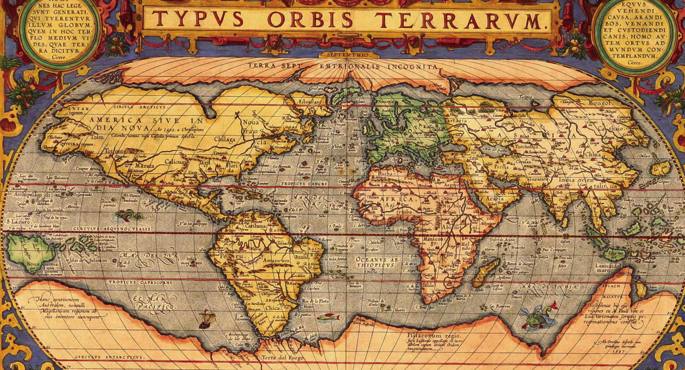
In the past, the earth was a flat disc surrounded by a large river (or that the terrestrial believed). C. was Thales of Miletus. In the seventh century, the Earth is spherical. But it wasn't very successful, and they used the record for centuries to draw the world, until the great Greek philosophers, and especially Aristotle, managed to impose their sphericity.
Once the form was definitively established, the Earth needed the measure, and the scientists worked on it. One of them was the librarian of Alexandria, Eratosthenes, in the 15th century BC. The third century. The technical barrier, the failures and the errors, got a surprising result: A circumference of 39,500 kilometers (the real is about 40,000).
But for the elaboration of the maps, it had to be taken into account that what was drawn on a flat surface, wants to reflect a really round reality. Once again, the Greeks were pioneers. In the 15th century a. In the second century, astronomer Hiparco made his first projections. Deformation was inevitable, but the aim of these projections was to disfigure the terrain as little as possible. From now on, however, the various interests would rather disfigure the maps, not the technical obstacles.
Meeting with the Church
The Romans remained on the map of the world, but if the Greeks looked at the sea, they looked at the land. Roman cartography had only one practical goal: to be an instrument for armies, tax collectors, etc.Los Arabs retained the knowledge of the
classics enriched with the advances of India and the Far East. But in Europe, images of the world based on pure religion became common in the Middle Ages. For example, those who divided the Earth into three symbolic parts, expressing each of the three known continents at the time. Europe and Africa were at the bottom, separated by a river, and Asia at the top, where it was then believed that paradise was present.
Those images that united geography and theology did not meet the needs of the sailors. So they began to build more useful maps on their own, using the compass from Asia in the 12th century. They were practical and quite concrete, but they had no other purpose than to facilitate navigation. As for the knowledge of the world, it was the “cartography” of the Catholic Church. For Europeans, the distant lands were filled with fantastic beings and undiscovered riches.
Strategic knowledge
In the 15th and 16th centuries, the horror of the European maritime powers revolutionized cartography. In just 50 years, the view of the world spread completely. In the Renaissance, science was liberated from the chain of religion and began to give the world what the mapper looks like today. Mercator, in the atlas published in 1569, gathered most of the characteristics of modern cartography and at the end of the sixteenth century, although there were still unknown territories, the world had a similar image to the present one.
But cartography became a fundamental strategic knowledge. Thus, the development of science, the increasingly modern measuring instruments, the discoveries of the territories of America and Oceania… brought increasingly accurate physical maps, but the limitations imposed by political interests provoked increasingly distorted political maps. For example, at the end of the Napoleonic wars, one of the main objectives of the Vienna Congress of 1815 was to redraw the political map of Europe. And there's no more than looking at the political map of Africa to realize the political disfigurement of cartography.
Moreover, for centuries, most of the world’s atlas has regarded Europe as the hub of the nerve. Eurocentrism has also been imposed on the world map. So we've gotten used to seeing our continent in appropriate proportions on maps all over the planet, without giving much importance to Oceania, Greenland, Alaska or Antarctica appearing completely deformed. As history's winners write, maps are drawn by the winners.
But you don't have to go far in time or space to witness the deformation of maps.
New wounds of the map of the Basque Country
“We have to prosecute and punish the schools that tell the history of Euskal Herria with Navarra,” said the President of the Government of Navarra, Miguel Sanz, in 2003. The former president of the Spanish Government, José María Aznar, for his part, launched in 2008 a “Euskal Herria is a fraud”. That same year, “Zapatero has given a period of two months for the term Euskal Herria to be deleted from the curriculum of Basque schools”, we read in an article in the journal El Correo. The Superior Court of Justice of Navarra declared all Basque textbooks containing the word Euskal Herria illegal.
By then, from day to day, the map of time in the Basque Country was changed. And today, if you go into the Euskalmet website, the map of the CAV appears in the first place, but if you click on a day, we can also know what time it will take in Iparralde and Navarra (even if the limits of the CAV are marked more clearly).
This kind of cartographic schizophrenia is more serious in education. In the textbooks in Basque the concept of the Basque Country is necessarily becoming the Basque Country, and the maps of the CAV are replacing those of the Basque Country. This means, for example, that last year a 12-13 year old student had maps of Euskal Herria in the Social Sciences book, and that next year he will only study Geography and History of the CAV. Regardless of ideological questions, the pedagogical logic says that the limitation of the medieval or medieval history of our territories to the CAPV and the exclusion of Navarre makes no sense. And, in the midst of the crisis, the economic logic says that preparing three separate textbooks for Basque students (CAV, Navarra and Iparralde) is not viable. But until logic prevails, students will learn an absurd Basque history without the Kingdom of Navarre, and those who study Basque in Navarre and Iparralde will have to imagine living in the CAV.
Towards social cartography?
The maperos or textbooks of time in the Basque Country still have work to adapt the maps to the will of the authorities. But in general, classical cartography is about to die, in favor of automatic mapping provided by new technologies. Google Maps satellite images have erased the romantic image of the cartographers painted by Vermeer, car browsers have replaced folding road maps of paper…
Some believe that new cartographers should resort to specialization if they want to survive. For example, one of the world's major challenges is water management, and hydrological mapping can have a future.
But there's a broader alternative: social cartography. In the words of Colombian anthropologist Vladimir Montoya, “official maps are tools of knowledge conditioned by the relationships of power and dependency. Censoring cartographic thinking eases geographic rigidity as demanded by power and introduces gaps, silences that the technique can solve but that the political order imposes”. In their view, maps not only represent the territory, but also create the territory. And social cartography should help create a fairer territory. He says that traditional cartography has been carried out by “external experts” and that social cartography should be done “from the inside”, that maps should be made taking into account the knowledge of all local social agents.
And so maybe the art of distorting territory starts to model territory.
XIX. mendean, Europako potentziek Afrikako kontinentea esploratutako eremuen arabera banatu zuten. Baina Afrikan lurralde gehienak kolonizatu gabe zeuden oraindik. Hala, elementu geografiko ezezagunei eta bertako biztanleek mendeetan mugatutako lurraldeei jaramonik egin gabe eskuaira erabiliz marraztu zituzten mugak.
Ingelesek bloke bat egin nahi zuten Kairotik Lurmutur hiriraino; frantsesek Senegaletik Sudaneraino; alemaniarrek beherago, egungo Tanzaniatik Kameruneraino; eta portugaldarrek Angola eta Mozambike batu nahi zituzten. 1884an Berlinen burututako biltzar batean mugako lerroak nola marraztu arautu zuten: kostaldean bi puntu markatzen ziren eta lehorrean sartzen ziren bi lerro marrazten zituzten laukizuzena itxi arte, laukizuzenaren barruko lurralde guztiak kolonizatzeko. Ederki ikusten a hori, esaterako, Nigerren, Togon edo Boli Kostan.
AEBetako estatuen arteko muga gehienak eta AEB eta Kanada arteko muga ere lerro zuzenez eginak daude. Baina Afrikan ez bezala, han biztanleria autoktonoa suntsitu egin zuten, eta biztanle berriek ez zuten arazorik izan beraiek jarritako mugetan bizitzeko. Afrikan, aldiz, mendetan etsai izandako herriak batu zituzten, eta batera bizitakoak banandu; eta kolonizazio errukigabea gatazka iturri da oraindik kontinente beltzean.
“Euskal Herria hitzarena edo lurraldeko maparena berria da, izugarria, gure izaera historikoaren muinaren aurkako erasoa. Sekula inor ez da ausartu hainbeste egitera. Etorkizunean existitzeko aukera ukatzeaz gain, sekula existitu ez garela diote” dio Jose Mari Esparzak Mapas para una nación liburuan (Txalaparta, 2011).
Lan horretan, Esparzak XI. mendetik hasi eta gaur arteko ehundik gora mapa bildu ditu, gehienak atzerriko bidaiariek, gerra kronikagileek, hizkuntzalariek… eginak, eta gehienak Euskal Herriko zazpi lurraldeak (edo Hegoaldeko lauak) biltzen dituztenak. Mapei lotuta, historian zehar euskaldunon lurraldeari emandako izenak ere biltzen ditu. Beraz, “nazioartean” onartutako lurraldea eta kontzeptua lantzen ditu liburuak, ez euskal herritarrek eman nahi izan dizkioten lurraldea eta kontzeptua. Frankismo garaian Espainian egindako mapa batzuek ere Euskal Herri osoa hartzen dutela ikus daiteke lan horretan, edo 1980ko hamarkadan Iruñeko Udalak argitaratutako liburu batek orain ukatzen den lurraldetasuna jasotzen duela.
Wasconia mapa batean lehenengoz irudikatu zutenetik mila urte igaro direnean, Euskal Herriko mapa (literalki) txikitzeko erasoak ugaldu dira; Esparzarentzat lurraldetasunaren aurkako “azken gudu modukoa” da. “Horregatik, horrelako liburuak beharrezkoak dira, sekula argitaratu behar ez liratekeen arren. Espero dezagun, egunen batean, guztiok begien bistakoa dena onartuko dugula”.


“Even with all the shortcomings, the unions have done more for humanity than any other human organization that has ever existed. They have contributed more to dignity, honesty, education, collective well-being and human development than any other association of people.” ... [+]

Harri-jasotzearen gorakada nabaritu da azken urteetan, batez ere emakumeen artean. Gazteek harri eskoletan ikasten dute kirolean esperientzia dutenengandik. Crossfit-a, sare sozialak eta telebista faktore garrantzitsuak izan dira kirolaren piztualdian, harri eskolekin batera... [+]

Rudolf Botha hizkuntzalari hegoafrikarrak hipotesi bat bota berri du Homo erectus-i buruz: espezieak ahozko komunikazio moduren bat garatu zuen duela milioi bat urte baino gehiago. Homo sapiens-a da, dakigunez, hitz egiteko gai den espezie bakarra eta, beraz, hortik... [+]
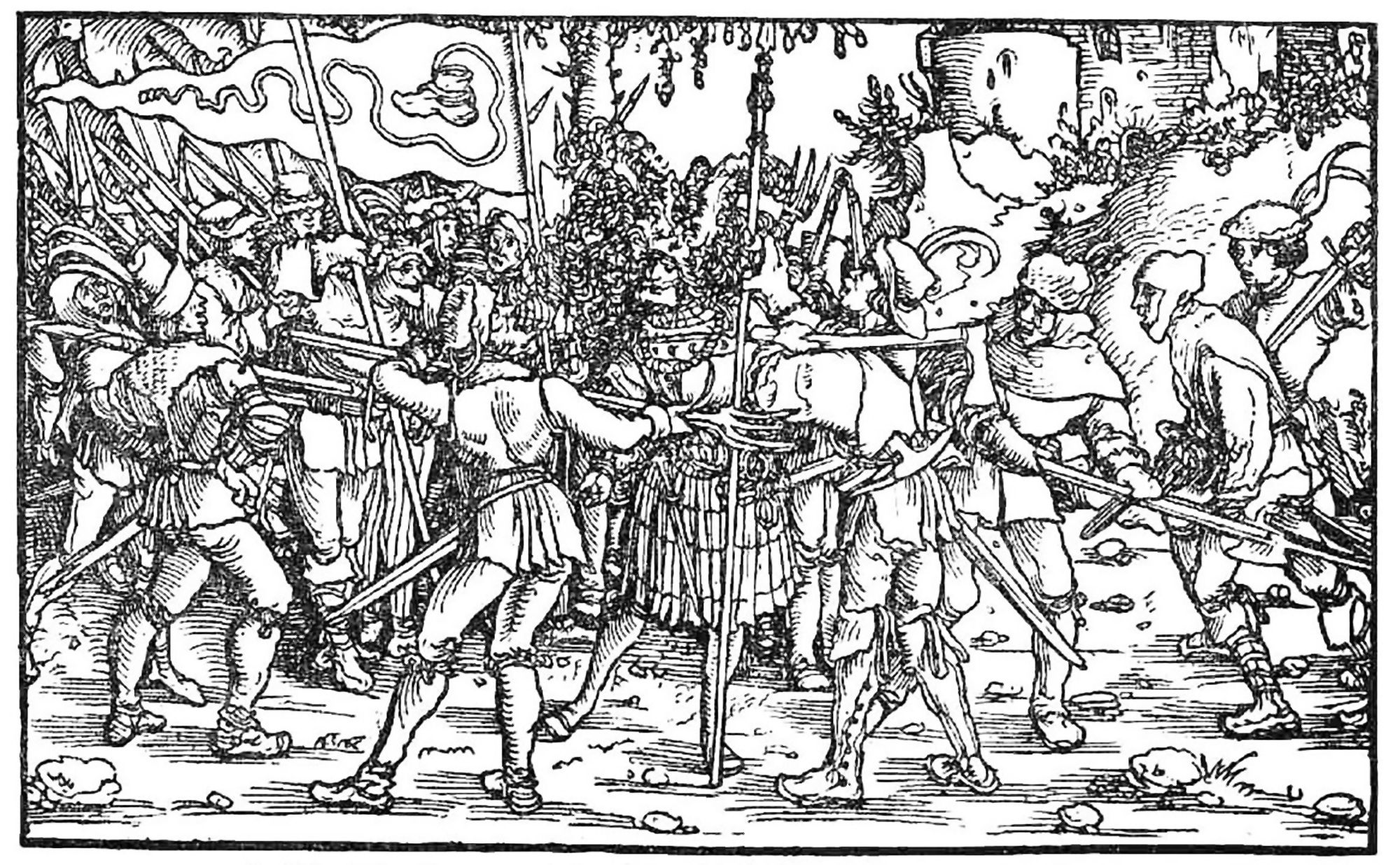
Böblingen, Holy Roman Empire, 12 May 1525. Georg Truchsess von Waldburg overthrew the Württemberg insurgent peasants. Three days later, on 15 May, Philip of Hesse and the Duke of Saxony joined forces to crush the Thuringian rebels in Frankenhausen, killing some 5,000 peasants... [+]
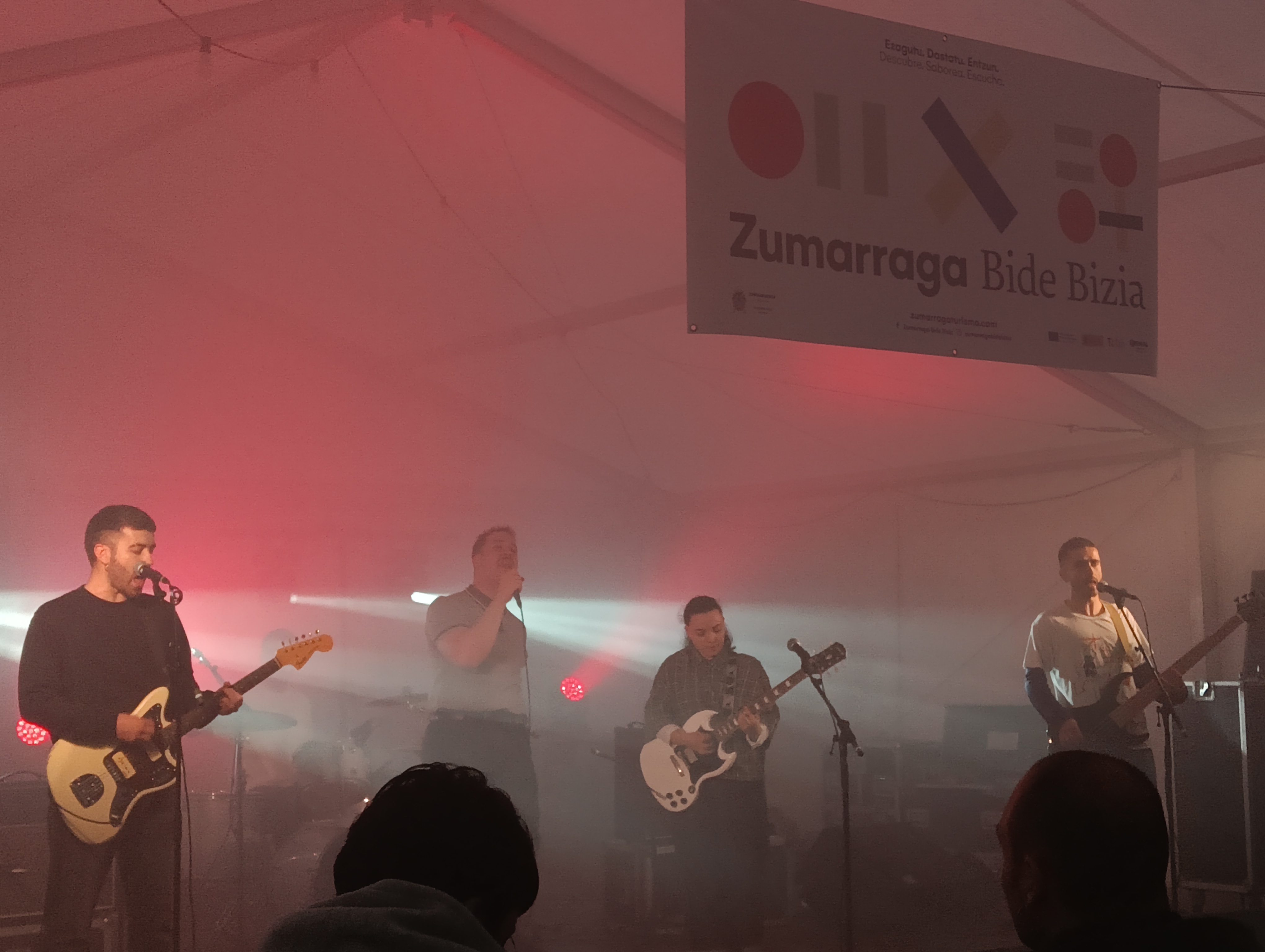
Aramu + AimarZ
When: April 26.
In which: The Zumarraga Open Field.
---------------------------------------------------------
The website of the City Council says: "The tourist brand Viva Viva and the festival of the same name are designed to show the world the soul of... [+]


Zenbait urtetatik hona sarri entzuten dugun kontzeptua da zaurgarritasuna. Gaur gaurkoz, diskurtso politikoetan pertsona zaurgarriez aritzea ohikoa da. Seguru nago nik ere inoiz erabili dudala berba hori Bizilan.eus webgunean, eskubide laboralak eta prestazio sozialak azaltzeko... [+]