
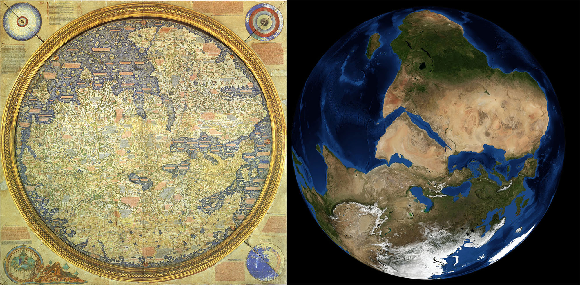
Venice, 24 April 1459. The monk and cartographer Fra Mauro finished the map of his world in his cartography workshop in the monastery of San Michele in Murano. This work was done on behalf of the Portuguese king Alfonso V.aren and, once the map was completed, it was sent to Portugal. That original map of the world was lost, but we had two copies, Fra Mauro died the following year, in 1460, while he was making a copy. Despite being cleric and not leaving Venice, it formed the most accurate map of the time.
On the world map of Fra Mauro, the south is up. The orientation of the maps is a simple cultural convention that has been changing over time, and at that time, in the Christian zone, many maps had the east at the top, where it is said that there was the garden of Eden, a point of reference. They also included paradise on the map. Fra Mauro also represented Edena, but off the map, in the lower left corner, almost like a simple decoration. He wrote in a note that this place was “far from human settlements and knowledge.” By then, south facing maps were made in the Islamic world, and the Christian monk had no objection to incorporating this trend of another culture and religion. In addition, Venetian boats departed south, that was their destination and their reference.
Fra Mauro, with the practical knowledge he managed to correct many errors that were previously made on the maps, asked the sailors.
The map contains over 3,000 notes detailing local customs, geographical peculiarities and the author's process. We know little about Fra Mauro's life. Experts think he may have traveled before he was Monje, but they're sure he didn't leave Venice until the map was completed. The monastery had a large collection of books and maps, that is, a cartographic theoretical knowledge of the time.
But until then he managed to correct many of the mistakes that were made in the maps by adding practical knowledge, asking the sailors. The source of information was Niccolo da Conti, an explorer and merchant, but not only collected what the Venetian seamen knew, but also asked a number of Muslim sailors, as well as a delegation from Ethiopia to Venice.
And this allowed us to infer that in southern Africa there was water, that it wasn't stretched to infinity, and that the Indian ocean wasn't an inner sea, as was believed from the time of Ptolemy. That the continent could be surrounded by sea. It was an alternative way to reach Asia and at that time there was a great need, as the land route was practically interrupted; in the last century the Black Death caused a massacre, the Mongolese dynasty in China fell and the Turks blocked the Mediterranean.
At the time, no one took advantage of Fra Mauro's hypothesis, but decades later, in 1488, Portuguese Bartolomé Dias came out of Buena Esperanza, and abandoned the beliefs and discovered that empirical knowledge was right.